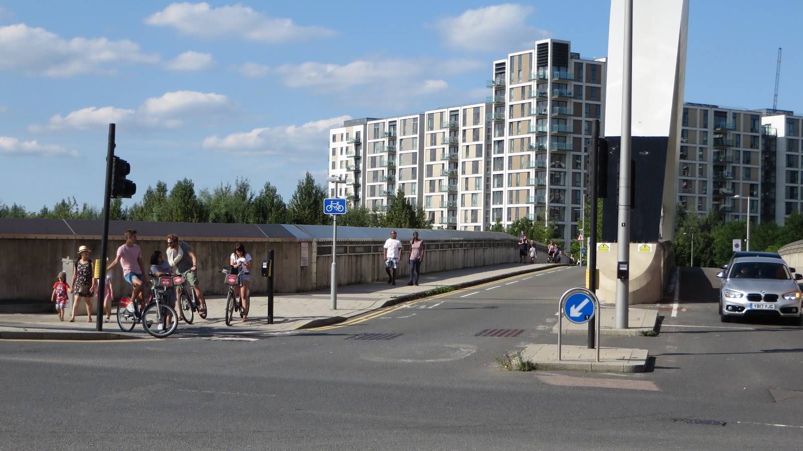
Wednesday, 6 December 2017

The Olympic Park in 2017, Part Three: Westfield Stratford City


The vote for the 2012 Olympic Games to be held in London was very close. Had Paris or Madrid been announced then it is likely that Waterden Road would still be bus depots rather than inspiring to be the home of digital startups and that salmon would still be smoked on the Industrial Estate where West Ham Fans now venture every other weekend. However Stratford City was already planned to be a new town centre on former railway brownfield land with shops, homes, community facilities and a bridge over the railway tracks linking it with "old" Stratford. Indeed even before the vote was announced Stratford International station construction was already well underway and it was around this area that development would continue. However the votes swinging in London's favour accelerated and expanded the development of this project, which was the reason the bid was made in the first place

Westfield Stratford City

Let us imagine you're in East Village and want to visit Marks & Spencer in Westfield, or need to catch a train from Stratford and want to get there via bicycle, as it is less athan a third of a mile away, as the crow flies. Your first route is either via Penny Brookes Street or International Way, both wide roads with wide footways and inadequate cycle lanes.


These roads join up with Montfichet Road, the main road running along the Eastern edge of the Westfield Shopping Centre and where the entrances to two of the three car parks are located. A bidirectional cycle track is located at the start of the road but you'll have to cross over three signalled toucan crossings to get to it. It is shielded from motor traffic by greenery


but then stops almost immediately to become a shared footway


It then restarts after a pedestrian crossing with markings on the road indicating for cyclists using the road to join in the obstacle dodging fun


That's assuming the cycle track isn't blocked off altogether of course


We're then back to a shared footway where you have to doge round trees


a bus stop


past the vehicle entrance to the Stratford City energy centre


around some more trees, cycle parking and a bus stop with barely enough space to actually ride a bike never mind sharing this space with people walking


and then to the pedestrian crossing, which leads to one of the main entrances to the shopping centre, and a cycle track the full width of the footway beyond that.


Crossing over the four lanes of traffic and we're at what is probably the busiest entrance and exit of Westfield. If you come to Westfield or the Olympic Park by public transport then the tube and train exit from Stratford station is here. The main taxi rank is also located at this spot and the terribly pedestrian unfriendly Stratford City bus station is a short walk around the corner. The area above here is also where pedestrians walking from Stratford town Centre on the wide bridge over the railway tracks will enter Westfield and there are lifts, stairs and escalators joining them together. It is also obviously a popular place to arrive at Westfield by bike, it being one of the few ways you can arrive by road and with some (poor) form of cycling infrastructure alongside. There did used to be a small amount of cycle parking here and it was hugely popular with often 3 or 4 bikes locked to every stand, I almost always used to (and still do) use the guarding on the opposite side of the road and walk over instead. Rather than expanding the hugely popular cycle parking here Westfield clearly saw it as a problem and so removed it altogether.


and so now the guard railing is covered with bikes on both sides at all times


Although I've noticed they've recently begun locking bikes here with their own locks with notices saying "Your bike has been locked due to it being parked in an unauthorised area" with the phone number 0208 221 7333 underneath, which I assume is the phone number you can call to ask Westfield why they do not provide adequate bicycle parking.

Less than ten years ago this entire area was completely undeveloped brownfield land, a complete blank slate to work on. They rebuilt Stratford station with a new entrance incorporated into the Westfield shopping centre, as a result the number of tube passengers using Stratford station has gone up from 22m in 2006 to 67m in 2016 and National Rail passengers using the station has gone up from 8m to an astonishing 41m in the same period. Not to mention the huge shopping centre with parking for 4,500 cars but absolutely no parking here for bicycles. Compare this to the new 12,500 capacity bicycle parking facility in Utrecht railway station in the Netherlands, which has also recently been renovated, just like Stratford. Why can't we be that ambitious in London?

Back on the other side of Montfichet Road there is a painted cycle track the full length of the footway from here to the junction with Westfield Avenue and it used to have a "no pedestrians" sign located on it at both ends, however this was replaced by "shared footway" signs early last year


The reason for this is because a new TFL cycle hire docking station was installed on top of half of the cycle track, however it was quickly noticed that no one was actually able to legally dock their bike here and walk away afterwards unless the signage was changed


This is a pretty inconvenient place to locate the docking hire stand, directly opposite the entrance to the other car park and around a 500 foot walk away from the nearest pedestrian crossing, with that walk having to take place on a cycle track. I don't think these stands get used much and I rarely see people walking here, but it is still a pretty shitty cycle track to use most of the time


However I certainly don't think pedestrians should have been banned from walking here in the first place. This road should be completely redesigned with one lane of motor traffic in either direction, which would leave ample space for people walking, a well designed cycle track and plenty of space for bicycle parking


At the traffic lights at the top of Montfichet Lane, where it climbs over the North London Line we come to the junction with Westfield Avenue; both of these roads and this junction were simply plans on a drawing board a decade ago. To cross over into Westfield Avenue from the cycle track by bike there is a toucan crossing over the four lanes on Montfichet Road and then a staggered toucan crossing over the five lanes on Westfield Avenue, with a wait in a caged pen after lane three, a manoeuvre that would be very difficult for a family on a cargo bike


Although this has always been the case since these roads first opened in 2011, what has changed is that there was a bidirectional cycle track running from here to the crossing leading from Westfield into the Olympic Park, which has now been removed

The beginning of Westfield Avenue in 2013 and this year, with the cycle track removed
This is the first section of the International Quarter and the cycle track here was ripped up a few years ago for construction to begin, along with one of the four lanes of Westfield Avenue. However whilst the dual carriageway has been perfectly restored the cycle track outside Glasshouse Gardens, the two residential towers which were the first section of the International Quarter to open, has been replaced by car parking

Westfield Avenue in the summer of 2013 and the same location this summer, with the safe space for cycling removed


I responded to a boastful International Quarter tweet regarding the great variety of transport links, referencing the removal of this cycle track, which they took exception to


Whilst the cycle track has certainly not been reinstated outside Glasshouse Gardens it has been reinstated, within the last few weeks, outside the freshly completed office block which Transport for London has just moved into (and as diamond Geezer points out, has 50 car parking spaces on the ground floor)


A major  issue with this cycle track that there is no way to get onto it from the toucan crossing further back, unless you cycle on the pavement. Perhaps this is what you're meant to do, but there are no shared footway signs to indicate this. If you're travelling in the opposite direction then there is no option but to use the pavement, apart from cycling the wrong way down a dual carriageway. The cycle track is also presently very short and terminates just before the next construction site at the point where the main pedestrian crossing from Westfield to the Olympic Park is being reinstated (thankfully as one direct crossing, rather than a two stage crossing with a congested wait in a narrow pen, as it was originally). However give way markings have been placed on the cycle track on approach to where this crossing will be


Which was exactly the case when the previous incarnation of this cycle track was here and this was the main issue with using it, as you had to give way to both people using the crossing as those waiting for the green man to cross, meaning you had to stop and give way at almost all times, rendering using the cycle track virtually pointless 


Westfield Avenue, despite being less than a decade old, was always a terrible road with a terrible, intermittent, debris-filled cycle track. It is quite a remarkable achievement that three years on from it being ripped up it is even worse now it has been reinstated and has partially been replaced by car parking! Thousands of people will work in these buildings and use this crossing to get to the Park everyday so this cycle track is useless in its current design. The construction of The International Quarter was a golden opportunity to finally sort out the mess that is Westfield Avenue and reconstruct the entire road. My hope that this would happen was briefly lifted two-and-a-half years ago, when I was shown plans to change this 


Yet here we are in an even worse position than we were when I first reported about this road back in 2013! 

Before and after in Nijmegen, a road with cycle lanes in the door zone is upgraded to cycle tracks behind the car parking. I used this road almost exactly a year apart. Why does it take us so long in the UK to sort out terrible road schemes? 


As pedestrian and cycle traffic is so high on this road and motor traffic seems to be very low (as the main car parks to Westfield are located elsewhere) it would make sense to make Westfield Avenue a through route for buses and cycles only. It closes every other weekend when West Ham are at home, or when concerts are held, and was closed for most of the summer when the anniversary games was on. Making the road accessible to buses only might be a good way to keep the road open during events and encourage people to arrive by bike and by public transport, with pedestrian priority

Construction work continues from here to what has been the main walking and cycling crossing over Westfield Avenue between the Olympic Park and Westfield / Stratford station for the last two years. What was the cycle track is now a building site and so so time will tell if that cycle track is reinstated and if so what quality it will be. This crossing was yet another staggered crossing with a wait in a pen in the middle, however prior to it becoming the only crossing point in 2014 it was rebuilt as a straight crossing. It is a very popular route with families on foot and bikes using it at all times


It also leads into Westfield shopping Centre and is the busiest place by far for people coming via bike. This is almost always where I lock my bike when I am shopping here and it is almost always full despite having a fairly large amount of cycle parking (for a UK shopping Centre)


I tend to end up using the railing in between the two sets of parking most of the time I come here, although I fail to understand why this space isn't just used for more cycle parking


It is especially tricky for parents on cargo bikes to park here


Another issue with this facility is that it is closed off every time West Ham play at home. I've lost count of the number of times we've parked our bikes here, headed off to the cinema and have a meal only to return a few hours later and our bikes are shut away and we have to walk though the car park to get them back out. (Tip: If West Ham are playing at home park your bike on Westfield Avenue alongside and enter / exit the shopping centre via the John Lewis pick up point).

The planting next to the bike parking was added quite a while after the bike parking and a cynic may argue that is was put there to both force cyclists to dismount on approach to the parking and to hide the bike parking from John Lewis customers. Either way it would have been a welcome approach from Westfield to use this space to increase the amount of cycle parking here, in what will always be the most popular place to come to Westfield by bike. Behind this cycle parking is a huge void, known as plot M7 and planning permission has been granted to construct a 14 storey tower here with over a hundred car parking spaces in the basement.  This would obviously be a opportunity to create a large underground bicycle parking facility to serve both shoppers at Westfield and people working at Here East and other areas of the park, who may commute in by train via Stratford. This will not happen though, and I've feared the construction of this tower block will instead mark the end of this bicycle parking. That was confirmed to me via twitter today


This is after they removed all of the bicycle parking in "the street" a couple of years ago, for no reason whatsoever.


Some of the abandoned bikes at the soon to be removed bicycle parking have been here for years (a certain pink framed bike must be on it's third Westfield Christmas) and I was surprised to learn, via Alex Ingram, that Westfield do count these bikes, they just don't remove them
You may notice in that monitoring report that the biggest bicycle parking location, with 164 spaces, had just one single bicycle in it all day and Westfield find it "particularly surprising that location 13 is hardly used because it offers caged, sheltered bicycle parking in close proximity to John Lewis / waitrose and Stratford International station". The answer should be obvious and that is: location! When I come to Westfield I am almost always doing so by cycling through the park itself and so the bicycle parking in the car park is not convenient, it is much quicker and easier to use this parking instead. In fact, it did recently occur to me that after coming to Westfield hundreds of times, I had never once actually used the bike parking in the car park and so thought it only fair to venture to see it. Firstly, continue along Westfield Avenue where the cycle track used to pause for a bus stop 


The bus shelter has now been removed but the bus stop remains active, meaning no where for people to sit and people cycling still have to steer around people waiting for a bus 


At the next junction you can either cross here by using four sets of crossings to get from one side of the road to the other 


Crossing from one side of the road to the other next to Westfield


Or you can carry on to use the staggered crossing at Olympic Park Avenue where there is another bidirectional cycle track on the other side of the road leading to the car parks, which is almost always littered with signage 


A look back at this area in 2007 on google earth shows that this was the location of what looks like a fairly good quality bi-directional cycle track, originally destined to only go to Stratford International. A shame this cycle track was never used as it was demolished before it could officially open. 


The original mostly continuous cycle track which was built when this road was under construction in 2005 and the modern short, obstruction filled replacement, via google earth

to access the bicycle parking, you must filter over to the right hand lane to turn right into the entrance to the car parks


there is zero chance of me using this route if I'm cycling here with my young daughter and I wouldn't expect other families on bikes to use this route either 


I thought I had found the bike parking and was impressed - two facilities either side of the motor vehicle entrance, with a dedicated route into it from the road


but alas, no, as the signage makes clear this is motorcycle parking. For the bike parking you have to enter via the vehicle lane, dodge under the barrier and then cycle round the car park to a small cage right at the back. I find it astonishing that Westfield find it "particularly surprising" that families on bikes are not using this facility!

I visit Westfield a lot and have spent thousands of pounds in here over the years. Sometimes I'm there just to pick up some food for tea. Other times we'll take a trip to the cinema and have a meal. Other times I'll spend a large amount in the department stores as I can easily carry several boxes and half a dozen shopping bags on my Dutch bike. I find it insulting the contempt with which Westfield treat people visiting their shopping centre by bicycle and with the removal of the most popular bicycle parking facility I may now have to take my Christmas shopping elsewhere

If you also use this bicycle parking facility due to be removed and wish to complain about this, you can do so here. 

Next Post:
Part Four: Sweetwater and Fish Island

Previous Posts:
Part one - East Wick
Part two - East Village and Chobham Manor

Tuesday, 5 December 2017

The Olympic Park in 2017, Part Two: Chobham Manor and East Village

East Village was previously known as the Athletes village, as it was where athletes competing in the Olympic Games stayed during the games. It was then converted into nearly 3,000 apartments and became a new neighbourhood in 2014. A small section of the next Neighbourhood, Chobham Manor, is already complete with people living in the section directly opposite the velodrome which was "The street market" during the games in 2012, where more expensive alternatives to the Big Macs that were on sale elsewhere in the park were to be found. The rest of Chobham Manor is currently under construction where the Basketball Arena and gigantic athletes dining hall stood in 2012 or where the Eastway cycle circuit and Clays Lane Estate stood before that

Chobham Manor and East Village

Yesterday I finished my East Wick post on the bridge on Waterden Road. To access East Village from here you will need to do a left turn onto Olympic Park Avenue. This is a manoeuvre I've had to make a few times in the past and now forward plan to avoid having to do it; instead I cross Waterden Road to go into Middlesex Way, across the bridges over the River Lea and then turn south onto Olympic Park Avenue to access East Village from there. This is a longer route but is much simpler, and crucially safer, due to this very junction. If you do have to turn left here then you have two choices; simply dart across the junction as quick as you can, crossing four lanes with no indication if the traffic lights on Westfield Avenue / Waterden Road will change to green. If this happens as you're halfway across then you're in trouble. The other option, the one the planners of this road hope you'll make,  is to use the toucan crossings alongside which involves a staggered wait in the middle of the four lane Westfield Avenue (although that wait is in quite a large space) and then another wait on the other side of the road in a very small area to cross Olympic Park Avenue. This involves waiting to cross the road three times and so will usually take you at least a minute to do this.

Olympic Park Avenue begins on a bridge crossing the tracks at Stratford International station. This bridge was again built in 2009/2010, just as the ones alongside Waterden Road were, but was opened to traffic in 2011 in order for motor vehicles from the A12 to be able to access Westfield. This was known as "the lifeline" as Westfield had agreed a deal with London 2012 to create a road through the Olympic Park building site ahead of the games. Only motorists were allowed to use it and there were security guards at the entrance at all times to ensure that cyclists and pedestrians were kept out. It was a dual carriageway back then but now that Waterden Road has opened it's been downgraded to one lane in each direction with two pavements and two horrible, very narrow cycle lanes

The Olympic Park Avenue bridge in 2012, from google streetview, and in 2017
Surely it would have been more sensible to keep two lanes on one side of the bridge and then convert the other side into a walking and cycling only bridge with both a cycle track and a pavement

An example from Amsterdam
This would not reduce capacity for motor traffic as there would still be one lane in each direction, however people would not have to cycle so close to large vehicles on such a dangerous and narrow cycle lane

The same spot in 2012 and 2017. Would you let your children cycle here?
A much safer example from Utrecht, the Netherlands.

The other advantage of this type of layout would mean it would connect up to the cycle track which runs down the western side of Olympic Park Avenue. At the moment if you're using this cycle track to cycle towards Westfield and you want to continue onto the bridge then you have to cross the road to get to the nasty narrow cycle lane.


Many don't do this and just continue to use the pavement of course


But are then left isolated and have to use the narrow toucan crossing to continue their journey. The cycle track on Olympic Park Avenue continues along the western side of the road but briefly pauses as it passes a zebra crossing into East Village (which really should be a tiger crossing but many people cycling to the shops and restaurants in East Village do just use it as well). Still, it does provide a safe space for children to ride, it is just a shame it is not continuous all the way up to Chobham Manor.

Communal barbecue spaces are located alongside here so no scorched grass. Very popular on sunny days. 
The cycle track ends as the pavement becomes shared space for a few metres before a no cycling sign appears at the junction with Honour Lea Avenue, which is where Quietway 6 crosses though the park. If these signs are to be obeyed then that means you are currently not allowed to cycle on quietway 6 at this location.


If you want to turn right from Olympic Park Avenue onto Honour Lea Avenue then you are meant to dismount, walk over the zebra crossing and then get back on your bike again.

Honour Lea Avenue runs between Chobham Manor and the East Village apartment blocks and will be the route of quietway 6. It currently has a narrow bidirectional cycle track, built in 2013/4 at the same time as the apartments in East Village were being converted from the Athletes village. It is difficult to access at either end and in my experience most people do not use it (but I always do)

A child and her mum safely use the cycle track, with the lone adult cyclist on a road bike opting for the main carriageway alongside
A real shame public money was spent on building this sub standard cycle track and it wasn't designed as well as new roads, and cycling infrastructure, are in the Netherlands. However, as it is due to become a Quietway and Chobham Manor is being constructed alongside then this would be a great opportunity to rebuild it as a wider cycle track with good connectivity at either end. Newham Council disagree though and state that:

Applying the LCDS levels of service street type matrix categorises Honour Lea Avenue into the local street category which does not require segregation. The existing two way track does not connect to cycle infrastructure at either end of it. Using the link for the quietway would restrict local access for the route therefore a preference for keeping the quietway on street has been agreed by Newham Council, TFL and Sustrans.

So the quietway will run along here but cyclists are expected to cycle on the road, rather than on the cycle track, despite the acknowledgement that motor traffic volumes are expected to increase here in the future. I also can't believe that this road is considered good enough to be a quietway now with no intervention, never mind in future years when the park is fully developed. Everytime I've been here there is the constant sound of motor traffic using it, quite often at high speeds, and there are no restrictions on them using it. It absolutely feels like a main road.

How comforting that Newham Council, TFL and Sustrans all agree that children can just mix with lorries on the road instead.

Another issue with this cycle track is that it did at least used to be continuous all the way along Honour Lea Avenue (except where it turns into shared footway for a few metres half way along). With the construction of Chobham Manor came the construction of new side roads crossing it, for construction vehicles entering the site and eventually as new roads into the neighbourhood. It would have been quite simple for the cycle track and footway to continue, ensuring pedestrian and cyclist have priority, but the road was instead built through the cycle track, with kerbs and tactile paving (and "cyclists dismount" signs during construction).

Honour Lea Avenue a few years apart. This is the kind of design which kills people on bikes 

The same spot in 2012, acres of space and plenty of time to get this right
There is also plenty of space on the other side of the road but a huge footway has been created when there is easily the space for cycle tracks on both sides of the road. And why not? Kids from these apartments in East Village will want to cycle to the playground or to use sporting facilities in the park too.

A footway wide enough to park your car on (despite car parking along both sides of the roads and in the basements of these buildings), with room to spare
A more sensible use of space in a new development in Delft, the Netherlands.
I find it worrying that Chobham Manor, despite having roads all the way round it, also plans to be dissected by more roads through it.


I would hope the plan would be to filter many, or even all, of these roads so whilst all residents can access their homes by car (including delivery vehicles and so on) they could only be used as through routes by people walking or cycling.

An as yet unopened road with freshly laid smooth tarmac to keep motor speeds high, through the middle of Chobham Manor
This would help ensure that young children could cycle from the front door of their house on virtually traffic free roads before reaching protected space for cycling on the main roads. This would bring the added benefit of quiet neighbourhoods for residents and permanent zones for children to play out in the street. Essentially what you see in every village, town and city in the Netherlands and in a few select areas here, such as in De Beauvoir Town. As some councils, such as Hackney and Waltham Forest, are currently pushing against opposition from motorists for more filtered roads it is such a great shame that here is the perfect opportunity to create living neighbourhoods from scratch being wasted.

A residential road through the same new development as above in Delft, motor vehicles can access every home but not use it as a through route, as it is filtered outside a childrens play area halfway long. On the other side of the houses are cycle tracks which connect to the back of all these properties and are the most direct route both through the development and into the city centre
Another missed opportunity here on a photo I took from the playground opposite Chobham Manor. This could be a great walking and cycling route by building a cycle track that links up with low traffic roads, creating a link right through the centre of Chobham Manor 
A cycling and walking route through a new development in Zoetermeer, the Netherlands. The entire area is cross-crossed by this type of design, with cars sent the long way round on separate routes
EDIT: a week on from writing this post and "Peloton Avenue" has opened


Back on Honour Lea Avenue and at the end of the cycle track the awful two-tier layout remains, with the cycle track becoming a shared footway and an ASL on the road alongside on quietway 6 "targeting less confident cyclists who want to use low-traffic routes" by expecting them to mix with lorries


Turn left here and a wider bidirectional cycle track resumes for a short while, before stopping again for a construction route (and presumably a permanent road) into Chobham Manor
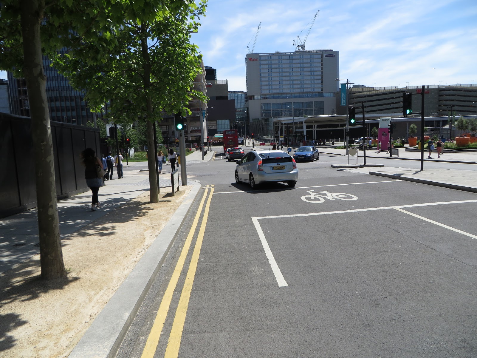


An example of a continuous cycle track and footway, in Amsterdam
This section of road was the boundary of the fenced off Olympic Park construction site and the google street view car made its way along here in 2009, giving us the chance to see how the road has changed in seven years:

Temple Mills Lane in 2009, with construction of the Athletes Village underway in 2009, and the widened road in the same spot in 2016, from Google Street View 
The cycle track also pauses for a bus stop, before resuming immediately afterwards

why don't some cyclists use cycle lanes? Just look at all the space that was available here for a continuous cycle track and bus stop bypass 

Continuing along Quietway 6 from Honor Lea Avenue onto the section of Temple Mills Lane that heads East into Waltham forest then the former advisory cycle lanes have recently been repainted as mandatory cycle lanes, and are a couple of inches wider.


but once again the Google Street View car came this way in 2009 giving us a chance to see the changes between then and last year. Clearly there was the space to be able to create protected cycle tracks all along this route from the Parklands into Waltham Forest.

The same location as above in 2009, via google street view
Finally, if you need to turn right from Honor Lea Avenue into Celebration Avenue from the cycle track then you have to cross over twice at the toucan crossings to use a narrow advisory cycle lane which runs all the way down the centre of East Village to International way, where Stratford International Station and the back of Westfield can be found.


Understandably, a lot of children prefer to use the pavement here, rather than chance it on the road!


Liberty Bridge Road runs off Celebration Avenue. Again, it is very wide (roughly 32 metres between the buildings either side) but the majority of space is used by large footways, trees and car parking.

Not actually a parking space but gives you an illustration of how wide the footways are here
Leading off from Liberty Bridge Road is Cheering Lane, a one way road which is there to serve Chobham Academy, the first school to open in the park in September 2013, but is also used as a popular rat run to avoid the traffic lights at the Liberty Bridge Road / Celebration Avenue junction. I wrote about the school run situation in this blog during the first year of it opening as a lot of cars were parking on the footway or on double yellow lines at school pick up time. I passed by here earlier this year to find a similar situation, so rather than taking photos I thought I would film myself cycling on it and post it on twitter


I was actually a bit late and the school pick up was already well under way so there were not as many cars parked along the road as there would have been ten minutes earlier but there were still a lot of cars and I happened to film an impatient parent in a BMW speeding along the pavement to dodge the queue of traffic.

The police did follow this up


and in the following weeks increased their patrols in the area during school run times. I thought I would pop along this month to see how the situation was and am sad to report it was even worse than it was in my film from earlier in the year with cars parked on all the footways and on double yellow lines both on Cheering Lane and Liberty Bridge Road. There were police officers and council officials there but they did nothing to stop any of the illegal parking, I assume they were only there to stop the type of footway driving I filmed or any road rage incidents. I avoid this area most of the time but especially at school run times, it is a really unpleasant place to be as a pedestrian or cyclist.

South of Liberty Bridge Road is Mirabelle Gardens, which I've written about before and the crazy one way road which runs around the square with no exception for people cycling. I've noticed a lot of motor traffic going into it from Liberty Bridge Road and quite clear they are using it as a shortcut to get to Westfield and avoid several sets of traffic lights on Celebration Avenue instead, as they do with Cheering Lane. It should ideally be filtered to through motor traffic but difficult to do with the one way design of it.

Opposite Celebration Avenue is Victory Park and a cycle track runs along the southern edge of it, which I previously described on here as going from nowhere to nowhere. However I've since realised that it does actually make a right turn and also runs along the western edge of the park, so badly designed was it that I had failed to notice this

The cycle track with it's 90 degree right turn
As it took me a couple of years of cycling on it to even realise it turned right at this point it is hardly surprising that many pedestrians do not notice the tiny bicycle symbols and assume it is an extension of the pavement, because that is exactly what it looks like.


A market is held here every Sunday and unfortunately some of the stalls are always placed on the edge of this cycle track, which clearly renders it virtually useless


Back in 2014 I didn't write about the area around Victory Park as it was just a load of empty retail units and an almost always empty park. The signs on the empty retail units promising "35 new shops, cafes, restaurants, pubs and bars" seemed optimistic at the time but now all of the units are occupied with some really great choices of restaurants and shops, albeit some of them a tad on the expensive side. A couple of coffee shops which originally stared out in Hackney, the same wine shop and Fish Restaurant that can be found in Victoria Park Village, an Ice cream parlour and fruit and veg shop who both use cargo bikes parked outside to advertise, Pave Velo, a bike shop where Lee and his team will service your bike or sell you one, the list goes on. It does not feel like Stratford at all; a really nice place to relax at the weekend and will only get busier as more residential blocks are completed nearby.

"Victory Parade" runs from Olympic Park Avenue to Victory Park and I used to enjoy the deserted cycle through here a few years ago. The situation is very different these days as you now must cycle among shoppers and people sat on tables outside cafes


I personally do not see this an an issue at all and think it is great to see families slowly cycling through here


I think pedestrianised streets which allow cycling can exist perfectly well in the UK, just as they do in the Netherlands and will do on a transformed Narroway in Hackney next year


I really hope that cycling continues to be permitted along here for future generations


Using this route to cycle to East Village from the parklands or the cycle track on Olympic Park Avenue should be maintained because unfortunately, most of the surrounding roads are truly terrible to cycle on.

Next Post: Part Three - Westfield Stratford City

Previous Post: Part One - East Wick