Showing posts with label Gouda. Show all posts

Wednesday, 10 January 2018

Cycling between cities in the Netherlands - Part Twelve: Gouda to Utrecht, via a different route

I've cycled from Gouda to Utrecht before, back in 2015, a journey that was mostly along a cycle track beside the N228, just south of the A12 motorway. This time around I decided to plot a different course running north of the A12 motorway, which would turn out to be a much more interesting and pleasant route. Before departing I spent the first part of Monday morning cycling around Gouda, taking pictures of people cycling before returning back to my hotel on the edge of the city to post about the school run I had just witnessed. After checking out of the hotel I was able to immediately cycle on a cycle track, which ran directly behind the hotel and led me under the A12 motorway and N451 road. I turned right to cycle alongside the A12 motorway but was shielded from it by a row of trees 


I crossed over a road, where the school / college run was still taking place and then continued alongside the motorway, safely separated from the lorries using it. 


This route would proceed along the A12 for the next few miles, with a few other people using it to get about their daily business, dressed in their daily getting about kind of clothes. As I approached the town of Bodegraven the cycle track gradually moved closer to the N459 road and as I briefly stopped to take pictures of a house on the outskirts of the town with an array of decorations, a man dressed in lycra on a road bike looked towards where I was taking pictures and stopped to whip out his mobile to take a few snaps as well. The bidirectional cycle track continued into the town and I then turned right onto another bidirectional cycle track alongside a road heading east through an industrial area in the southern part of the town. There were a lot of lorries using this road, so I was glad to be separated from them. As the road turned north along the edge of the residential part of the town I couldn't help notice that you could access several residential roads from here by bike but not by car. Direct routes for those on bike or on foot, whilst those driving have to go the long way round. I passed under the railway line and then turned right as I approached the Oude Rijn river to cycle along a narrow path along it. 


This route would continue for around the next five miles, nestled between the houses and the river, a very nice and relaxing ride. After briefly stopping at a bench to eat a sandwich I continued on to the village of Nieuwerbrug, where the riverside path was restricted to pedestrians only and so I joined the road through the village before rejoining the path, which was being used by more people fishing than it was cycling. 


As I approached Woerden I once again left the path to join the road, a road which had no cycling infrastructure on it and it felt very British, before I turned left to where a tiled cycle track was available. I turned right, onto painted cycle lanes and cycled behind a teenager carrying some long piping, before turning left to use one of the few crossings of the circular moat/canal to get into the very centre of the city. I could have bypassed the centre altogether of course but thought it was worth a look whilst I was in the area. Once in the centre I cycled around a section of the inner ring road, which was one way (anticlockwise) for motor traffic but two way for cycling. 


A bit of an odd arrangement and I didn't think much of the painted cycle lane for those cycling anticlockwise, who had to share the road with buses. I then cycled south down Rijnstraat, a shopping street accessible by people walking and cycling only. I then used a small section of the inner ring road again to access a walking and cycling only bridge over the moat and out of the centre. The cycle track directly passed outside the railway station before looping under itself and leading me to a bidirectional cycle track alongside one of the main roads East out of the city. 


There were a couple of secondary schools located alongside this road and so naturally there were students cycling along the cycle track all the way out into the countryside. As the road turned north the cycle track turned into a narrow access only lane and continued alongside the railway line. 


I then turned left to cycle over the filtered lane that I had just used. From here I cycled on a road for a short while before being directed onto a narrow, unmarked bidirectional cycle track on the other side of the road. It soon switched to the other side of the road and became a marked, tiled cycle track. Crossing over the next T-junction I turned right onto a bidirectional cycle track, which narrowed before a left turn onto a road with painted lanes at each side, although this was being used by a family of cyclists.


The countryside suddenly gave way to housing as I reached the outskirts of Utrecht and after navigating a large roundabout I used a cycle track which became a service road. I then crossed over the road onto a wide cycle track which ran between the main road and the housing alongside. As the main road elevated over a road, the cycle track stayed at ground level, giving way to the next road along but then climbing back up to run alongside the main road again. 


I turned left at a cycle crossroads and passed under the road and railway line to cycle alongside Utrecht Terwijde railway station, although I'm not sure why I did this as to continue directly along the lovely wide cycle track would have been the most direct and more pleasant route. I soon turned right to go back under the railway line and road and then left to rejoin the cycle track. 


As the track lifted up past Utrecht Leidsche Rijn Railway station I looked to my right to see construction of this new neighbourhood underway, completely unaware that I was also passing over the A2 motorway, which had been buried underground in this spot between 2007 and 2012 to make way for this new development. As I looked down at the building work I could see people cycling through the construction sites; clearly they had built the cycling routes long before they had built the shops and houses that will one day be here. I passed over the canal and a long descent down from the bridge, past a wide, main road that will soon cease to exist and into the centre of Utrecht. 

Distance: Approx 40km /  25 miles
Time: Approx three hours
Photos taken: 380
Map of the route
Gallery:  62 photos here


An analysis of this trip by Jitensha Oni:


Previous Posts:

Part One - Hook of Holland to Rotterdam / Photo gallery of this journey
Part Two - Rotterdam to Gouda via Delft / Photo gallery of this journey
Part Three - Gouda to Utrecht / Photo gallery of this journey
Part Four - Utrecht to Amsterdam / Photo Gallery of this journey
Part Five - Amsterdam to Hook of Holland via The Hague / Photo gallery of this journey
Part Six - Hook of Holland to Breda / Photo gallery of this journey
Part Seven - Breda to Eindhoven via Tilburg / Photo gallery of this journey
Part Eight: Eindhoven to 's-Hertogenbosch / Photo gallery of this journey
Part Nine: 's-Hertogenbosch to Nijmegen / Photo gallery of this journey
Part Ten: Nijmegen to Utrecht / Photo gallery of this journey
Part Eleven: Hook of Holland to Gouda via Delft and Zoetermeer / Photo gallery of this journey

Monday, 8 January 2018

Cycling between cities in the Netherlands - Part Eleven: Hook of Holland to Gouda via Delft and Zoetermeer

For the third summer in a row I arrived into Hook of Holland, via an overnight ferry from Harwich, to spend a week cycling around the Netherlands. My previous two visits to the country had started by cycling into the small town to buy some breakfast from a local bakery, however this time I gave into the constant PA announcements and ate a buffet breakfast on the ferry itself. It wasn't a particularly satisfying meal and was considerably more expensive, therefore I expect to return to buying my breakfast from one of the local bakeries on my next trip to the country. However, choosing to eat on the ferry meant that as well as skipping a visit into the town I could use a cycle track for the first time; one which runs directly from the ferry terminal to the N223, alongside the railway line. To get to it I crossed what used to be the railway line but had been completely ripped up to be transformed into a metro line. The cycle track here is not particularly wide or even that well maintained, with some obvious temporary carriageway repairs, but as it is just a short route to and from the ferry port it isprobably only going to be used by tourists like me a couple of times a day. Still, it is nice to be able to use a cycle track almost as soon as you pass through passport control!
At the end of this cycle track I reached the N223 where instead of continuing along the water towards Maassluis as I had the last two times, I turned left to head north out of Hook of Holland via a bidirectional cycle track alongside the road. I crossed over the road, passing a couple of people on road bikes, enjoying an early Sunday morning ride on the same smooth cycle track as I was using on my heavy, luggage loaded Dutch bike. I soon turned right onto a track through fields 


and couldn't help notice that the barriers had been removed as I reached a road, something I would soon get used to on this trip as this seems to be recent common policy in the Netherlands. The cycle track continued alongside what seemed like a very quiet country lane before I turned left onto a narrow path along the waterway


I turned right into a newly created underpass, built out of what used to be a road when the junction was upgraded. Whilst some may criticise the Dutch for building new roads and junctions to increase capacity for motor traffic outside of their cities they do at least always upgrade their cycling infrastructure at the same time to improve journeys by bicycle also. This allowed a smooth, pleasant and safe journey through this junction, without interacting with motor traffic for me and others. Crossing over the road I used an old tiled cycle track, these are never as pleasant as the newer smooth asphalt cycle tracks but do still allow safe cycle journeys for those young and old


I passed alongside, but not under, another new looking bicycle underpass (this time with the barrier removed) and then turned right onto a cycle track between greenhouses, running parallel to the road on the other side of the greenhouse. I climbed up and over the "De Snelbinder" cycling viaduct, which you can read about on the Bicycle Dutch blog here, a very thorough explanation of why I had passed under and over recently reconstructed roads in this area. I briefly stopped to admire another cycle track from above before a hooped descent back down to ground level and then rejoining a narrow road alongside the water. There were a few houses and businesses located along here but no cars to be seen, only other cyclists and geese. The road bent away from the water as I continued my journey past numerous greenhouses and associated farmhouses, before a left turn led me onto a cycle track through fields


this was being used by people rollerblading, cycling and walking. I cycled underneath the N223 and then alongside it for the next mile and a half, safely separated from lorries alongside, before crossing over the A4 motorway into Delft.

I had visited Delft before, when I cycled from Rotterdam to Gouda back in 2015. I enjoyed my time there and vowed to come back one day and so spent the next hour exploring new developments on the edge of the city
I then cycled into the historic centre of the city to eat some lunch, passing by a supermarket which Mark Treasure writes about here, admiring the upgraded cycle infrastructure as I approached the centre; it really is remarkable and very impressive at how the Dutch continually improve their streets

Following lunch I continued on towards Gouda. I had made the same trip by bike between these two cities two years earlier and so took the opportunity to travel via a different route and to visit the city of Zoetermeer along the way. I began my journey out of the city alongside the new railway station, behind a family cycling. I turned right and cycled along a canal, over a filtered bridge and then down a residential road, also filtered to motor traffic at the end. This then became a pleasant path alongside the water


through woods and then past a large lake, which many people had come to enjoy via bike. The path continued with woods to my right and housing on the other side of the water to my left and was good enough to be used by all kinds of people on bikes . I crossed over a small bridge and then turned right (with another wide, pleasant cycle track continuing straight on to head south)


To my right, in the far distance, I could see other people cycling in small groups of ones or twos along another cycle track through the open countryside, running parallel and just under a kilometre away from the track I had just used. It really is exceptional to see how the Dutch have this wonderful dense network of cycle tracks criss-crossing through their rural areas, far more extensive than their motorway or railway network is. I turned left onto yet another cycle track


and then through a cycling crossroads and under the road the other cycle track I'd just given way to ran alongside. I passed through another similar looking underpass, this time under a railway, crossed over a road and then continued on through countryside and woods, with the cycle track being used by all kinds of people. A very pleasant part of the journey. As I reached the outskirts of Zoetermeer I could see on my map that a cycle & walking bridge existed over the A12 very close by and so took a short detour to go and have a look. Whilst pedestrians had a direct flight of stairs to the bridge those of us on two wheels had to take a long uphill route, turning three times to get there, and so soon started to regret my detour. The bridge wasn't particularly noteworthy but offered a view down to the cycle track which ran alongside the motorway underneath


Turning back the way I came I didn't have to go all the way back down to where I had started as another cycle track joined up halfway down, which led me through a not particularity pretty residential area. However it did provide safe conditions to cycle both alongside the roads and through housing developments and the greenery which surrounded them. As I came to yet another cycling and walking only bridge I remember thinking how amazing it was that people cycling have such a wide variety of direct, safe and obstruction free routes before remembering that this is really exactly how it should be. I then went through a business park, a very odd route for the fietsersbond route planner to choose but at least I was getting plenty of variety. I continued for a short section along a bidirectional cycle track beside a road and then turned left at a crossroads, although it was only a crossroads for people cycling, who had priority here


This was a quiet residential road with painted cycle lanes, which then became a cycle track under the railway line and A12 motorway. I turned right to travel along a cycle track beside the motorway, but with sound barriers present to reduce the noise of traffic. I also passed over other cycle tracks which were also running beneath the motorway and railway line


From this point the quickest and shortest way to get to Gouda would have been to continue along this cycle track alongside the motorway, which would have taken me directly into Gouda. However to my north lay Oosterheem, a new residential area of Zoetermeer and having been impressed by the cycling provisions of the new residential developments in Delft earlier in the day I felt it would only be sensible to detour at this point to go and take a look. I turned north and headed through a residential area and onto a bicycle road, the closure of the route to motor traffic under the road bridge making this safe for parents to cycle with their children, rather than the cycle marking "quietway" nonsense you get in London. I briefly stopped off at McDonalds, something I never do at home but the free wifi and decent toilets make this an attractive stop for coffee when I'm on long cycle journeys in the Netherlands. The cycle parking was well used and as many people seemed to be coming and going by bike as they were by car. 

Oosterheem was as great to cycle around as I was expecting it to be. A network of cycle routes separated from the road network crossing each other, with several cycling and walking only bridges, far more than existed for people in cars. These all linked up with each other, leading directly to residential properties and local amenities such as shops and the railway station, with ample bicycle parking. The main school and nursery alongside had a wide continuous cycle track right past it, whereas the road was access only for motor vehicles and could not be used as a through route. Meanwhile back in the UK and Sadiq Khan plans to tear down cycling and walking only routes in the Olympic Park to create new roads for motor traffic right past schools and homes! It began to lightly rain as I headed out of Zoetermeer towards the A12 motorway and then alongside it.


This was all very familiar as it was the route I had taken two years earlier, although as I approached Gouda the roadworks that were there had been completed and a fresh cycle track had been relaid

The same spot in 2015 and 2017

Turns out that these roadworks I had seen back in 2015 were the beginnings of a brand new road, now completed, which lead me through unfamiliar territory before seamlessly joining up with a more familiar route which took me into the centre of Gouda.

Distance: Approx 60km /  37 miles
Time: Approx  seven hours (several of those were spent cycling around Delft and Zoetermeer in circles)
Photos taken: 880
Map of the route
Gallery:  78 photos here

Ann analysis of this trip by Jitensha Oni:

Previous Posts:

Part One - Hook of Holland to Rotterdam / Photo gallery of this journey
Part Two - Rotterdam to Gouda via Delft / Photo gallery of this journey
Part Three - Gouda to Utrecht / Photo gallery of this journey
Part Four - Utrecht to Amsterdam / Photo Gallery of this journey
Part Five - Amsterdam to Hook of Holland via The Hague / Photo gallery of this journey
Part Six - Hook of Holland to Breda / Photo gallery of this journey
Part Seven - Breda to Eindhoven via Tilburg / Photo gallery of this journey
Part Eight: Eindhoven to 's-Hertogenbosch / Photo gallery of this journey

Part Nine: 's-Hertogenbosch to Nijmegen / Photo gallery of this journey
Part Ten: Nijmegen to Utrecht / Photo gallery of this journey

Monday, 26 June 2017

Picture Post: 30 minutes of the school run in Gouda

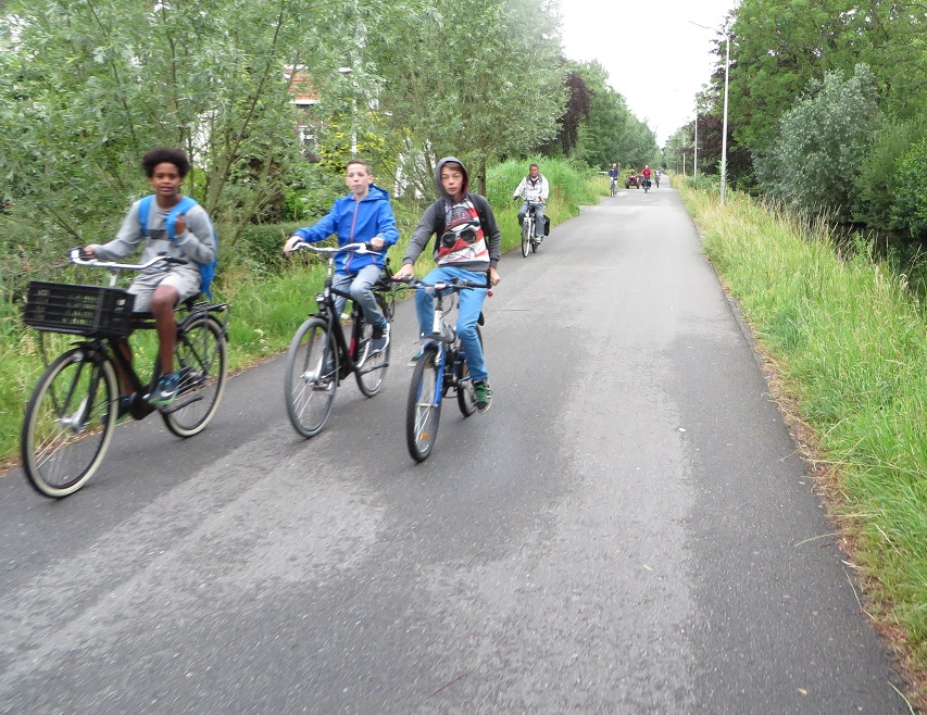
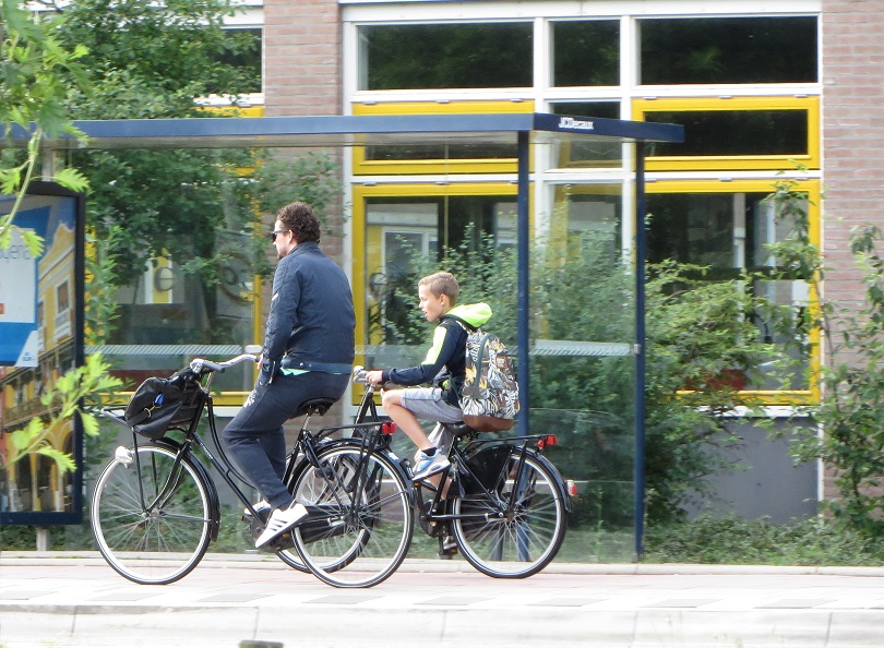
This morning I cycled around the city of Gouda between 8.00 and 8.30am taking pictures of people cycling. As with any city there were many children going to school at that time and most of them were doing so by bicycle, just as the majority of school children also do every morning throughout the Netherlands.

Below is a selection of those photos in the order I took them. A snapshot of children going to school by bike in Gouda.


Below: the bicycle parking outside a school before and after the school run in Gouda