
Part One: East Wick
East Wick is the region of the Olympic Park which is located within the borough of Hackney; the name was suggested by Hackney resident Oliver O'Brien, a geographer who created the bike share map. Whilst the Copper Box has been open for four years as a local sporting venue and many people are now employed within Here East (which is where the worlds media were based in 2012), most of this area is either still empty tarmac or parkland. The grass and tarmac will shortly be removed to become a huge construction site as a number of residential blocks are built, creating a new Hackney neighbourhood.
 |
| East Wick |

 |
| The cycle track allows you to safely breeze past the queueing cars on their way back to the A12 from Westfield or West Ham each Weekend |
Unfortunately whilst the cycle track is open past the Copper Box the northern half has been closed since early 2016 to allow the International Broadcast Centre to transform into Here East. On a positive note there is a well signed diversion via the back of Here East onto the Lee canal towpath. It has even been filtered recently but those bollards are very close together and not particularly accessible for anyone travelling on a cargo bike

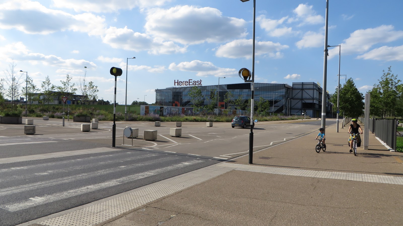
Here East is the home of BT Sport and is usually a quiet place, although that won't last for much longer as the plan is to have 7,500 jobs located here one day. As well as the bidirectional cycle track running along the front of the main building there is a lot of bike parking available. Directly to the north of the main building there are 51 Sheffield stands on the large footway with another 40 stands inside locked sheds alongside. In "the yard", a landscaped area between the two main buildings, lies another 20 Sheffield stands and another 20 inside locked sheds, enough space for over 260 bicycles to be securely locked directly outside the main entrances. According to the Here East website there are also two cycle hubs, one inside each of the two main buildings, enabling parking for 450 bicycles, along with a "campus repair shop". There are also two TFL cycle hire docking stations with spaces for 42 hire bikes. Meanwhile the enormous multi storey car park, which takes up nearly as much space as the main building, has recently been refurbished and provides more parking for cars than is available for bicycles (although at a cost).

Most will not come here by bike or by car but will do so via Public Transport. Bus route 388 from Elephant & Castle now runs directly outside Here East (although whenever I see one it is almost always transporting air through the park). Hackney Wick station on the overground is a short walk away but Stratford station, which serves the majority of people visiting the park via public transport, is around a 20 minute walk away. I first noticed the "BT Sport minibus" a few years ago, the only real sign that BT Sport were located in the Park. It took me a while to figure out that this bus was continually driving the 0.8 mile route between Westfield and Here East all day long to transport BT Sport workers to and from the station (I assume Gary Lineker and Rio Ferdinand use the multi storey car park!) Here East have now joined in and have three brightly coloured buses making the same journey every five minutes. There is of course a bidirectional cycle track (mostly) linking Here East with Stratford station but there is a severe lack of cycle parking at the recently built Westfield and the recently rebuilt Stratford station, which we'll come to later in the week.
The back of the smaller Here East building (which was the Main Press Centre during the games) has been renamed "Canalside" and is now home to several trendy bars serving craft beer and burgers to mostly young professionals on deckchairs outside. It is very modern day Hackney Wick and can get busy, especially on sunny days. As it's on the canal a lot of people arrive here by bike and there is cycle parking available

Which was then extended as there wasn't anywhere near enough

but there still isn't enough bike parking at peak periods so hopefully more can be added, as there is certainly the space for it. A handy byproduct of Canalside is that the former road, which ran here during the games transporting journalists to and from the venues, is now a wide shared path and acts as an overflow for the congested and narrow towpath. Whilst sipping beer in the sun I've seen people divert away from the crowded towpath to use this section, even though it makes their journey a bit longer


South of Canalside is Mossbourne Riverside Academy, a new Hackney Primary school which opened in September 2016 and so currently houses local reception and year one pupils. Noticeable is the large amount of childrens bikes parked in the yard alongside the canal during school hours. At 3.30pm each day young Hackney cyclists emerge from the playground, lucky that they have motor free canal paths, cycle tracks and bridges nearby to get them home
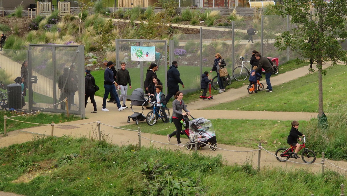

But not everyone cycles in Hackney as every afternoon at least a dozen cars park up on the footway out the front of the school to drive their children home, I even saw one child ride their bike from the school gate to a Range Rover about 50 metres away where it then went into the boot!

The slope alongside the school, which leads from the canal up to "Copper Street" and the Copperbox, was originally built with stairs and a meandering zig zag path alongside for those on wheels. People cycling or with buggies were not keen on making six sharp turns on the way up or down and so most would travel directly down the slope. Barriers were added and then continually knocked down and rebuilt, until the park management gave up and installed a rubber mat on it. A shame they didn't just design it properly in the first place!

In front of the school a new road was constructed at the same time as the school was being built. So narrow was it that I originally thought during construction, or perhaps more likely hoped, that this would become a cycle track or a narrow filtered road. However that is not the case; it is just another narrow road directly in front of the main school gates

Children use the pavement to get to the school by bike, as you'd expect
 |
 |
| A year apart, in 2015 and 2016 via google earth |
A shame it didn't stay that way, at least for motor vehicles, as another through road already runs just slightly north of this street to access the school and the back of Here East so this road outside the front of the school really isn't needed
 |
| A filtered road outside a school in Delft, the Netherlands, one of many filtered roads I have cycled on past schools in the Netherlands. The main road near here is safe enough for children to cycle on too! |

However there is no dedicated cycle crossing over Waterden Road and so almost everyone goes onto the pavement and uses the zebra crossing a short distance away instead

Ideally a tiger crossing would be built here to replace this, perhaps with a cycle track on the south side of Copper Street, where there is ample space between the street and Copper Box.

Just south of here is a set of traffic lights outside Copper Box where the large RUN sign remains as a reminder of the 2012 games
 |
| During the Olympic Games in 2012 and in 2017 |
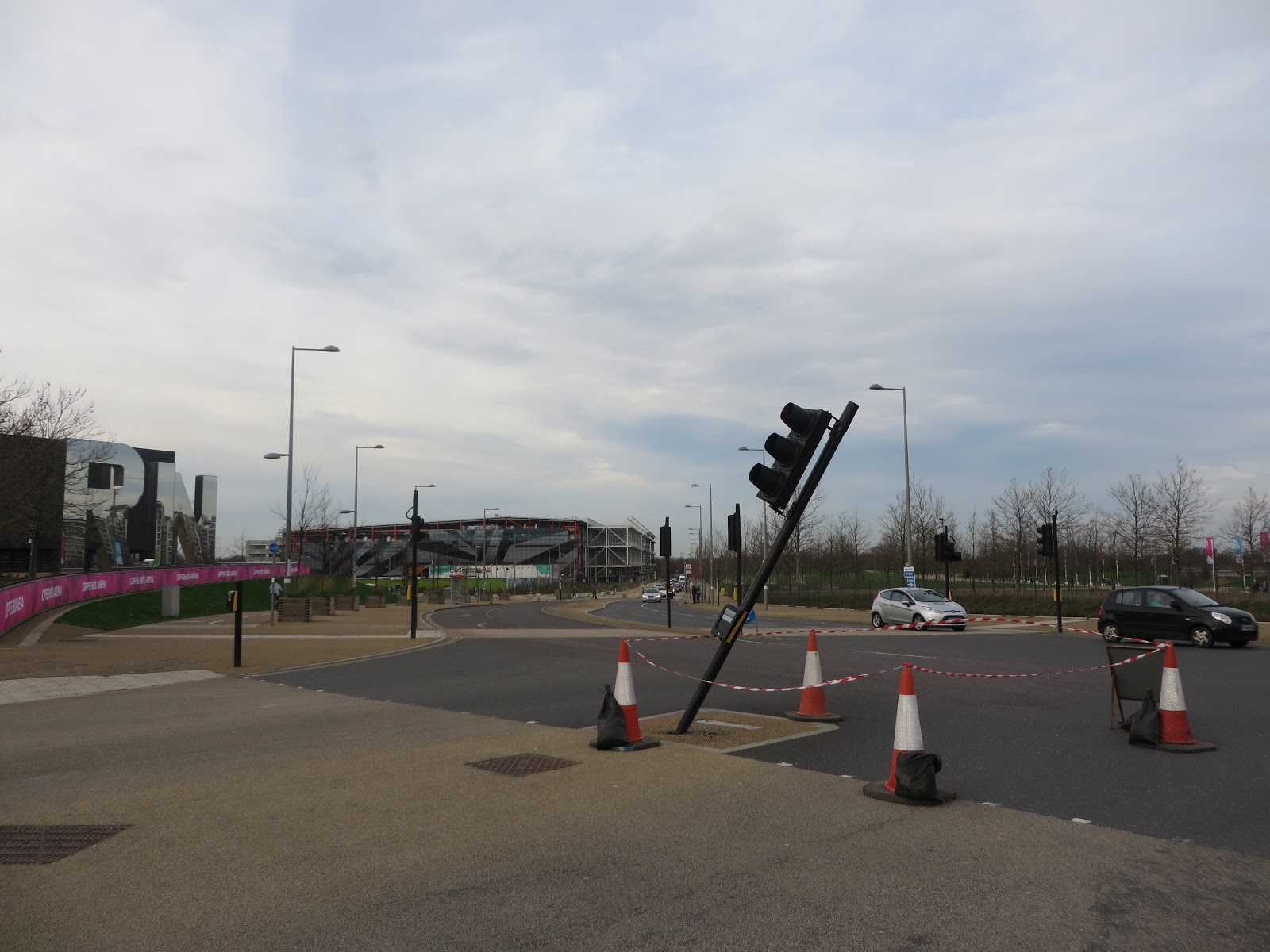
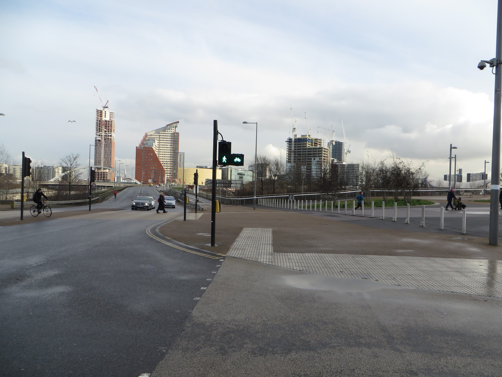
The traffic lights allow traffic to access a road over the railway on a bridge that has been there since at least the 1920s and one of the few pre-2005 features which remains. This road is currently called Clarinco Lane (named after the Clarnico factory) but used to simply be the southern section of Waterden Road. It leads down to Carpenters road and what will soon become Sweetwater but will be demolished soon as a series of residential blocks are built on the land surrounding Copper Box, the railway line and the energy centre. The route to Sweetwater will instead use the wide bridge which was built during 2009 to 2010 and was a very busy thoroughfare which linked the two halves of the park during the Olympic games. It was also where Gary Lineker and others presented the BBC Olympic Games television coverage from the top of a stack of shipping containers
 |
| A wide path that is well used by people walking and cycling today |
 |
| This route is used by families on bikes all the time, it will clearly need dedicated, protected cycle tracks if this is to continue |
 |
| Yet another new road coming to the Olympic Park |
 |
| A T junction in the suburbs of Amsterdam, very similar to how the new road layout in the Olympic Park will be. Bidirectional cycle track run along both roads and connect seamlessly, with pedestrian priority crossing the cycle tracks |

The main issue at this location is that the cycle track on Waterden Road (viable in the distance in the photo above), which runs all the way from Eastway / The A12 to Westfield, simply stops at this junction as it becomes a shared space area either side of the crossing, leading to confusion at times
 |
 |
| A shame the cycle track gives up shortly before each crossing to become a shared footway |

 |
| A standard design for a crossing in the Netherlands, defined space for where bikes and pedestrian cross the road. The lady with the dog also has a newborn baby strapped to her chest, so safe is the cycling infrastructure provided for her |

This will also become a road, although crucially not for through traffic, it will be there to service the back of the apartments, which will be built on the grass to the left of the photo above. Lets hope it is filtered at several points to ensure motor traffic is kept to an absolute minimum and this can then continue to be a major route for people walking and cycling.
 |
| The road on the other side of the parked cars here is a low traffic residential street but as this is such a popular cycling route from Vondelpark to the west of Amsterdam this cycle track was installed recently for the convenience, comfort and safety of people cycling |

It is quite remarkable just how much this junction has changed in the last ten years and inconceivable no protected cycling infrastructure was built to safely allow people cycling to navigate through here
 |
| The junction of Eastway and Waterden Road, before the Olympic Park construction began and today, via google earth |
To the south of the borough Waterden Road now turns East and continues into Newham over the River Lea. This road was constructed during 2005 and was intended to be the link road into Stratford International station from Waterden Road but then London unexpectedly beat Paris to host the games and so it became a realigned Waterden Road instead. It was originally one lane in each direction with a bidirectional cycle track and pavement alongside but the cycle track and pavement were removed so the road could become a dual carriageway instead.
 |
| The unopened single lane carriageway "Stratford International Station link Road" with a bi-directional cycle track in 2007 and ten years on, now a dual carriageway and a renamed Waterden Road extension |
 |
| The original bridge,which was under construction in 2005 when London won the bid, and the additional bridge constructed during 2009 to 2010, seen from a boat on the River Lea |

Although the barriers are a bit restrictive and should be re-positioned

The cycle track is then pleasant to use for a while, although when events are on in the stadium barriers are placed in it to ensure pedestrians do not walk in the road as they swarm towards the car parks at Westfield but are not positioned to stop them from walking in the cycle track .

and then onto another bridge

which again was constructed in 2009/10 to allow the road to be widened from its original two lanes to four, which again has a painted cycle track (which has faded since it opened in 2013). Once you cross this bridge you can continue onto Westfield Stratford City or turn left to go into East Village and Chobham Manor, where my journey continues tomorrow.
Next Post: Part Two: East Village and Chobham Manor
The whole of the Olympic park is really depressing. Not really a park, more a collection of fields bisected by dual carriageways. Almost all of the park does not feel welcoming to pedestrians or bike users.
ReplyDeleteI often try and bike from Stratford station to Hackney Wick/Hackney Marshes. Even after many attempts, I've no idea how to do it and usually end up wheeling my bike through the shopping centre, riding on the dual carriageways and then trying to remember where I should cut down to the canal.