Friday 12 January 2024

Downham Road

Downham Road in the London borough of Hackney runs between the A10, close to Haggerston Overground station, through to the junction of Southgate Road at the Hackney / Islington borough border. It does also continue west into Islington, however, since 2020 has had a filter placed west of the Southgate Road junction as part of the Canonbury East Low Traffic Neighbourhood. However the section within Hackney is most certainly not a low traffic street with nearly 8,000 motor vehicles a day using it, making it a very unpleasant road to cycle on, one which I avoid and go out of my way not to use, wherever possible.

It really does feel like a road that has not changed since the 1960s/1970s. In fact, as far back as the early 1970s local children stood on Downham Road and campaigned for this road to be closed to though traffic, following the successful closure of Northchurch road, the next road to the north from Downham Road, to through traffic. 

Local children campaigning to make Downham Road safer in the 1970s, it remains almost exactly the same now as it did then. Image taken by Neil Martinson. 

In typical 1960s fashion it is also a very wide road, which results in many motor vehicles travelling at high speed. I happened to be walking along Downham Road at school pick up time a few years ago and witnessesed the aftermath of an overturned car that couldn't possibly have been driving within the legal 20MPH speed limit.  
The only benefit of Downham Road being very wide is that this would allow for a considerable redesign of the road and there is very clearly ample space for protected cycle tracks, something I pointed out 7 years ago using a comparison with a road I had also cycled on before and after a redesign in Nijmegen, the Netherlands:
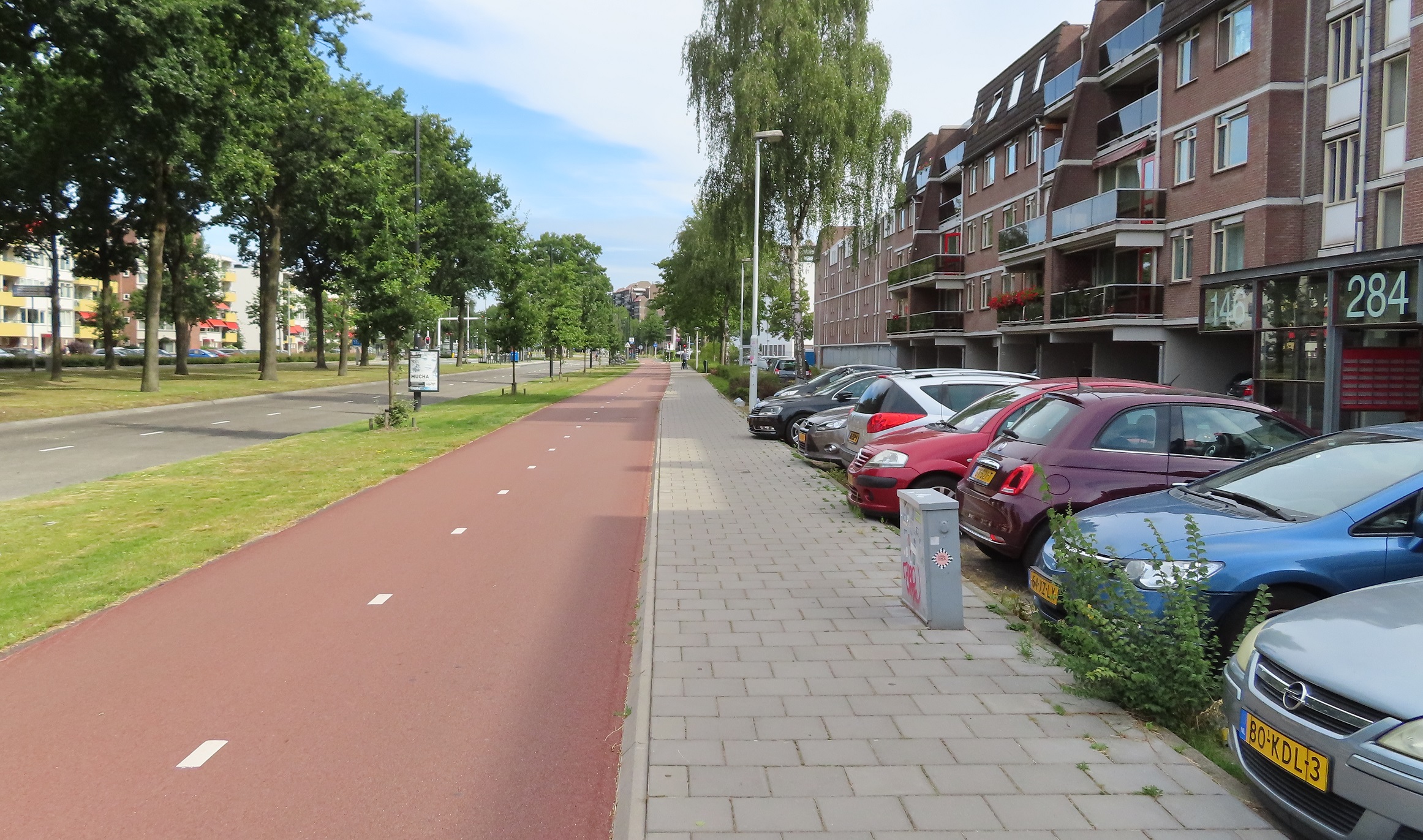
Google Streeview of the street in Nijmegen in 2016, before improvement works to this wide street began

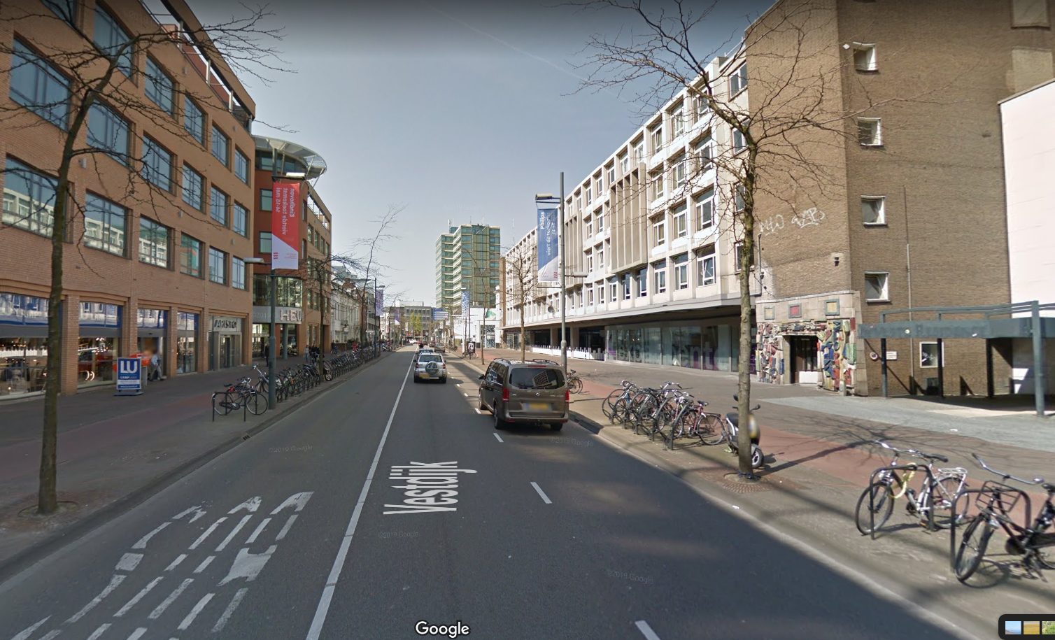
The same location in 2017, after improvement works. A street that now prioritises people, who no longer have to cycle in the door zone of parked cars inches away from speeding cars. A good example of how to upgrade your streets and a ideal solution to Downham Road.

A new Primary school opened on Downham Road in 2015 and has been situated at three different locations since then; initially just 50 pupils taking up a couple of floors of what was then Hackney New School (now known as Waterside Academy), opposite where its current home is. 

After two years and growing to 150 pupils it then moved into a temporary new space using portable cabins at the other end of Downham Road, opposite Ufton road, where it remained until it moved into its now permanent location on the site of the former fire station on the corner of the A10 and Downham Road. This does mean that some of the pupils who were the first to enter this new primary school fresh from Nursery back in 2015 are now teenagers, and unfortunately had to put up with 7 years of a school run along a hostile, busy road with many of them forced to cycle on the pavement every day throughout their primary school years, often alongside their parents. 

Both the school and local parents pushed the council for changes to a safer road layout, the demands increasing as the number of pupils attending the school grew each year. In 2021 officers from the Hackney Council streets department had a walk around with parent representatives from the schools Air Quality and Road Safety Group. A list of not very impressive "improvements" were put forward including bike stop boxes at the traffic signals and pavement build outs. Council Highways officers also "discussed the difficulties with including separate cycle lanes" to which the parents obviously expressed their clear objections to the ridiculous suggestion that primary school children cycling to school should be expected to navigate new pinch points in primary position amongst thousands of cars and lorries when there is ample space for protected cycle lanes as part of a new layout. 

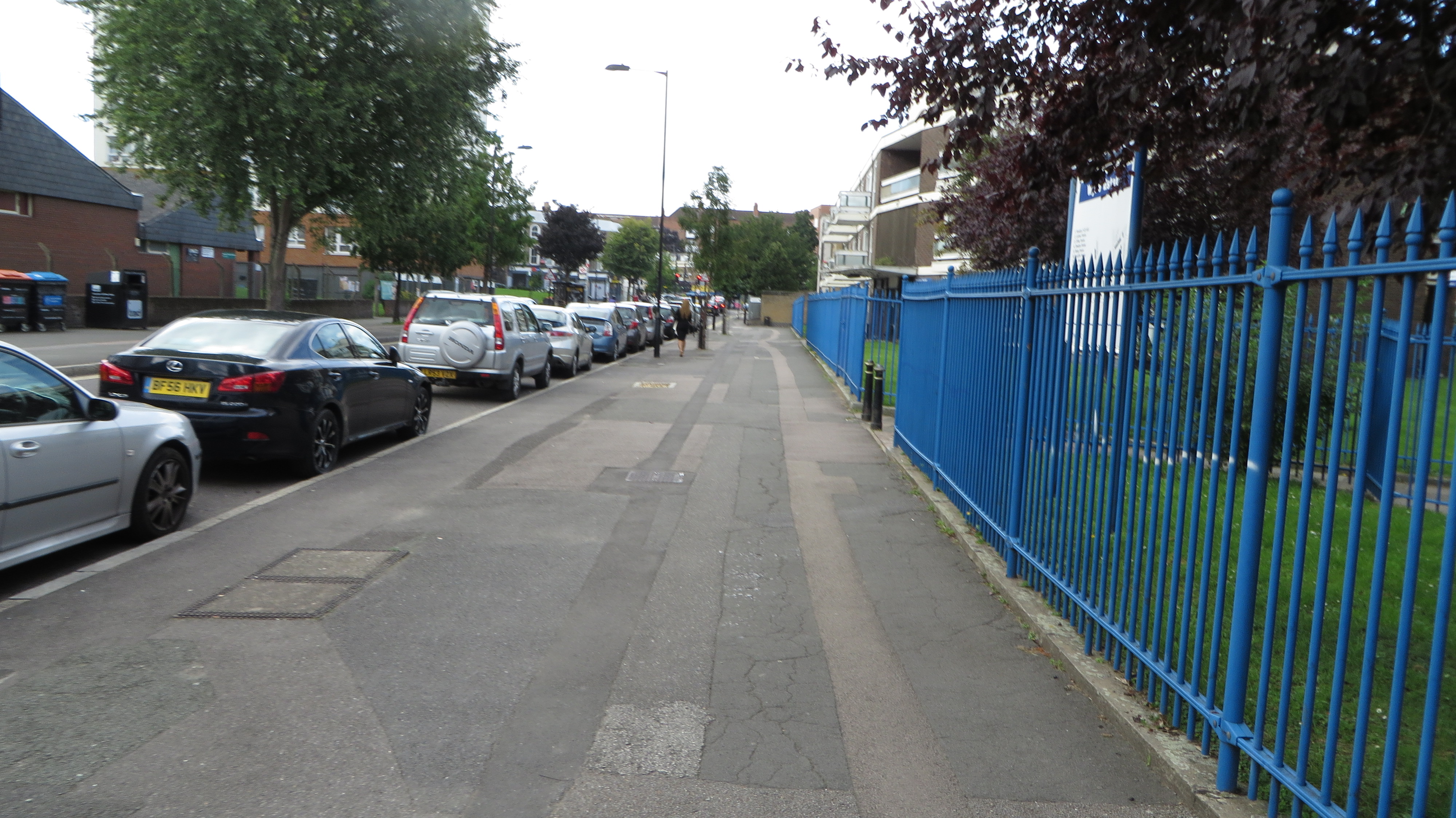
Downham Road outside Hackney New Primary School at afternoon pick up time. It would be preposterous to suggest primary school children are safe cycling among motor traffic here.

Following these objections, despite repeatedly suggesting that introducing cycle lanes on Downham Road was "not suitable", without ever giving any reasoning for this, the council then announced they had designed two options; an unsafe option 1 with a narrowed carriageway and no safe space for children to cycle, and a safe option 2 which considered the needs of all road users and included footways, cycleways, a roadway and greenery / pedestrian crossing points. 

I attended the drop in public engagement session on Downham Road in November 2022 where the unsafe and safe proposals were presented. Perhaps naively I was expecting this to be an actual fair and  reasoned engagement and figured that surely everyone would agree that the correct conclusion was that option 1 was a ridiculous concept to even consider on a road with a primary school that carries 8,000 motor vehicles a day. 

Below: Option 2 on display at the public engagement. Not a bad design, only negative would be the loading bay in the cycle track (easily solved by moving it around the corner into Hertford Road) and ideally swap the greenery so it is in between the cycle track and roadway but generally a decent design. 


Below: A before and after of the same location on Queensbridge Road in Hackney, less than a kilometre from Downham Road, which was upgraded with cycle tracks outside Haggerston School in 2020 by removing car parking.

Any preconceptions I had that this "public engagement" was a genuine exercise to explore and discuss the two options were dashed as soon as I walked through the door, where I was approached by Hackney Council middle aged man number one who showed me the "beautiful" option 1 on a large A1 piece of paper, where the greenery and planting was endlessly highlighted. He then proceeded to tell me that "some cyclists" want cycle lanes here and "we would have to remove all of the car parking for these people". He then stared at me, clearly desperately hoping I would be a local car driver ready to object in writing. When I informed him that it was utterly ridiculous to suggest that option 1 was safe for children to cycle to school he lost all interest in the conversation and turned away, approaching other new arrivals, clearly hoping they were local car drivers. 

I examined the two proposals further and then became engaged in conversation with Hackney Council middle aged man number two and Hackney Council middle aged man number three who proceeded to "explain" to me the issues that cycle lanes cause for disabled people, both completely unaware of the great advantages cycle lanes can have for people with mobility issues.

The conversation then turned to pedestrians where middle aged man number two informed me that at the proposed informal crossings where "cyclists don't stop for pedestrians" pedestrians would "have to wait four times" to cross the road and proceeded to act out a ridiculous impression of someone crossing a four lane high speed motorway.

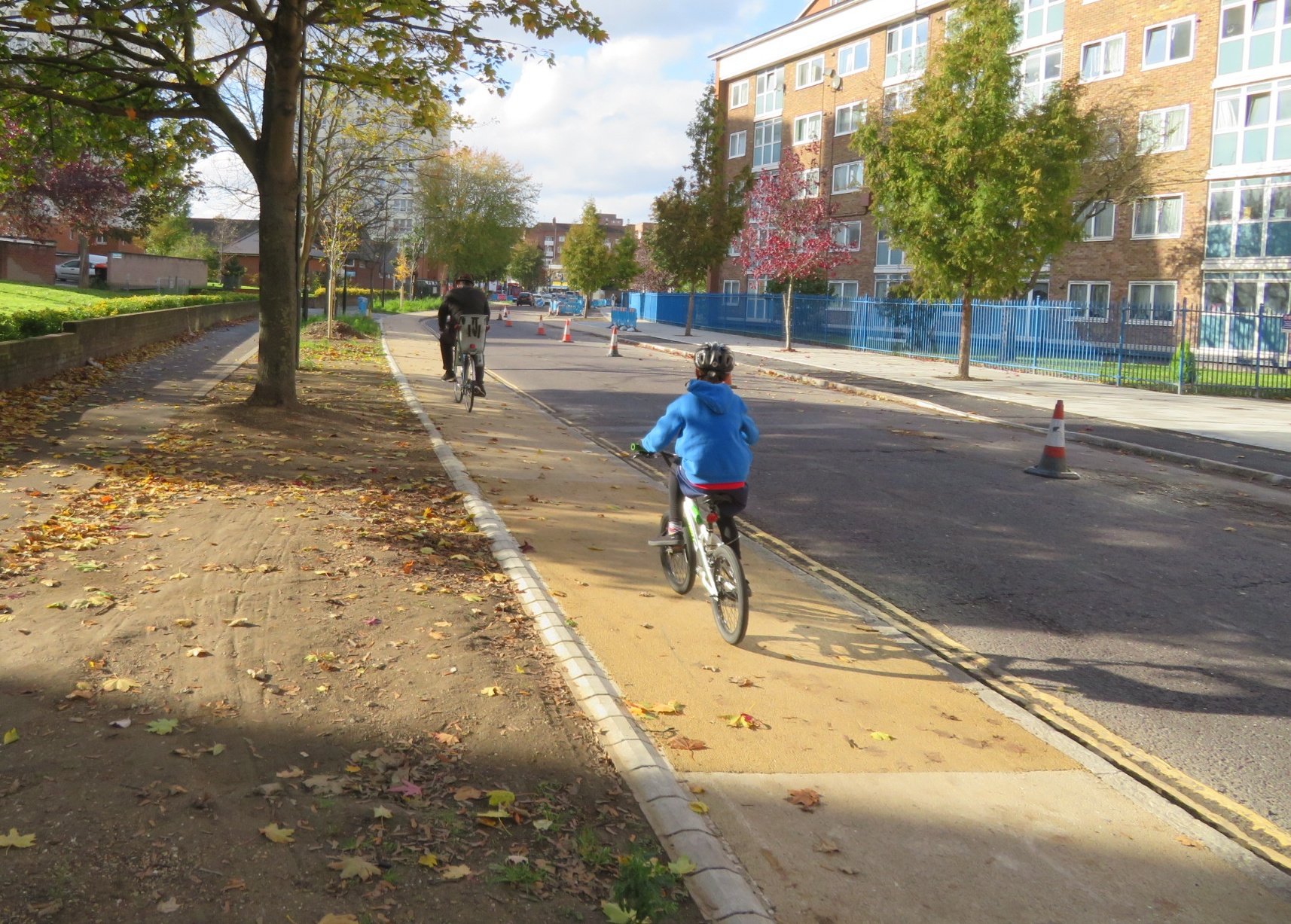
Below: Wick Road in Hackney where pedestrians do not have to wait four times to cross the road at this informal crossing, they simply wait until there is a gap in traffic in both directions, same as they would without the cycle lanes.


As depressing and ill informed as these views were they were not surprising. Hackney Councils highways team have long been a band of middle aged men with a seriously unhealthy dislike of protected cycle tracks and absolutely no empathy for children or families cycling on their road network. Clearly this has been influenced from years of leading figures within the council such as former councillor Vincent Stops, who now spends his days obsessively campaigning against safe cycle infrastructure all day long on twitter, only getting attention for London cab drivers and anti LTN conspiracy theorists, along with former Hackney Council principal transport planner Roger Blake: 

Hackney Councils middle aged men have form for this kind of design, back in 2015 they proposed a redesign of Wick Road from a busy one way road to a busier two way road but without protected cycle tracks. In the consultation only 32% of local residents supported the designs with 68% of local residents voicing their opposition to the unsafe plans. Fast forward two years and an improved design with protected cycle tracks (with the loss of 110 car parking spaces to accommodate them) was presented. This gained 71% support and 26% disapproval from local residents and the scheme went ahead successfully. 

Before and after on Wick Road. The original rejected consultation was to keep all the car parking and have no safe cycle tracks, exactly as is being proposed on Downham Road. 

Steer Group were commissioned to analyse the public engagement results and also the proposed design options from a technical point of view. They concluded that "option 1 would not be safe for children to cycle on the traffic lane, especially during peak hours as current traffic is greater than 6,000 pcus/day" (The London cycling campaign currently state that streets with motor traffic levels above 2,000 PCUs/day cycling should be physically separated from motor traffic to allow people of all ages and abilities to cycle). The Steer report states that "Option 2 (one-way 2m-wide segregated cycle lanes on either side of Downham Road) comfortably meets LTN1/20 standards for with-flow cycle tracks and would be suitable for ages 8-80". 

A large part of the assessment was on the impact to motor traffic, with a Hackney Council "target" to retain car parking and the school pick up / drop off by car. The report concluded that "under Option 2, school pick-up/ drop-off from private motor vehicles won't be permitted along Downham Road. It is therefore expected that pick-up/ drop-off will be displaced to surrounding streets (i.e. Hertford Road, Enfield Road). On the other hand, the proposals will encourage active travel (walking, cycling and scooting) for getting to and from the school which should mitigate the adverse impact to the surrounding road network."

A further ambition of Hackney Council to retain car dependency in the borough was "the future delivery of kerb side electric charging for motor vehicles". The report stated that "future kerbside usage is limited with Option 2. The addition of a segregated cycle track along Downham road inhibits available space for any future electric vehicle charging infrastructure along this route, the removal of parking bays makes the creation of electric vehicle parking bays unlikely, though this is not necessarily a negative feature given aspirations to reduce motor vehicle usage across the borough."

With regards air quality the report concluded "The proposals are more likely than Option 1 to create a mode shift from motorised traffic to active travel modes, particularly cycling, therefore in the long-run, air quality could improve along the route, as fewer people choose to drive."

Another target for the council was alignment with the Draft Climate Action Plan, Hackney's Transport Strategy, Hackney's Child Friendly Borough policy, and the Mayor's Transport Strategy.  The conclusion regarding the unsafe option was: "Option 1 Plan outlines ambitions to convert road space to public realm, SuDs and other uses. This option would achieve this aim, and likely make it more pleasant and enjoyable to walk, however it would do little-to-nothing to improve the cycling environment, which would not assist Hackney with achieving its aims of increasing journeys by bike and is unlikely to attract new users."

In the public engagements 101 people attended. 11 people felt option 1 was unsafe for cyclists, with 7 concerned that no cycle lane was provided. 15 people supported cycle lanes in option 2, however 16 people did not support the reduction in car parking as a result of cycle lanes, 8 raised concerns about anti-social cycling behaviour, 7 "objected to cycle lanes" with 7 also stating that cycle lanes were unsafe for pedestrians. The report concluded the most negative concern regarding option 2 was the loss of car parking. The report concluded that "in general more negative themes emerged form option 2 than from option 1" and on that basis the council are now only proposing the unsafe option 1 for public consultation. They fail to state how many of the 101 participants were, like in my experience, subjected to council officers voicing nonsense scare tactics regarding protected cycle lanes.

Opposition to cycle lanes in consultations are nothing new. Look in detail into any cycling consultation improvement scheme from the last few years and you'll find plenty of objections regarding red light jumping, not paying road tax and all sorts of other nonsense. These views are obviously disregarded in most consultations but were actively encouraged and are being used here as a reason for the council not to provide a safe environment for 300 primary school children. Just imagine a local authority in the Netherlands publishing such nonsense about anti-social cycling behaviour!

Similar responses were received in the Wick Road consultation in 2017 where comments received included "some cyclists are endangering pedestrians, "cyclists ride anywhere they please",  "everyone cannot be riding bicycles to everywhere", "will the council be enforcing the law about lights on cycles at night", "cyclists don't give much thought for anyone", "I am worried that fast cyclists on Wick Road will be dangerous" and "the arseholes pay nothing towards the roads and you fuss over them". 

Before and after on Wick Road where the council reasonably rejected the small number of anti cycling comments and provided a safer layout for children. However similar anti cycling comments are now being used to justify an unsafe layout for children on Downham Road.

Back in 2016 Hackney Council proposed some cosmetic changes to Whiston Road to create a "cycleway" and I wrote about the consultation in 2016 and then also wrote about the changes once they were implemented in 2017. The end result was similar to what is being proposed on Downham Road, lots of car parking and cyclists expected to "man up" and cycle in primary position in the roadway. A Hackney council middle aged man even responded to concerns regarding he pinch point build outs by stating in the consultation report that "cyclists will be in the primary position when approaching these build outs reducing any risk of conflict with traffic following behind". 

Below: before and after "improvements" to Whiston Road. No, the young child and her mother are not cycling in primary position in front of lorries on Whiston Road; they are cycling on the pavement as that is the only safe option for them. The exact same option that school children on Downham Road will have to use if this unsafe scheme goes ahead. This is as a direct result of the way these roads are designed by the middle aged men at the council by not providing safe cycling conditions for all residents.


Despite £640,000 being spent on upgrading Whiston Road, and despite the "Q" signs still displayed on the roadway this road is no longer a cycleway as TfL have now stated that it fails to meet their safety standards. Tragically a young mother was recently killed cycling here, the third cycling death in less than a month in the borough. 
I find it absolutely astonishing that just a few months on from this preventable death the council are now proposing a similar lethal design for Downham Road, on the back of 16 people objecting to the loss of car parking and 7 people commenting on anti-social cycling. Incredible. 
Meanwhile, in the Netherlands....
Back in 2019 I saw on the municipality of Amsterdam website that a new school, for both primary and secondary school children, was being built in the South of the city and, as a result, a new road layout would be designed and that it would coincide with the school opening. I had no idea how the redesign would look but I was intrigued and headed down to the location whilst I was visiting the city a short while later. I came across a road that didn't look too dissimilar to Downham Road, and just like Downham Road, had probably not been upgraded for decades:

The road as pictured in 2019, car parking on both sides of the road (the parking on the left is suspended as building work had just started on the school). Quite a similar layout to Downham Road. 

I then went back to the same location once the new school had opened in 2022, here is the exact same location as above, three years apart:


In order to create safe space for children and parents to socially cycle in large numbers side by side the road has been transformed from a wide two way road, into a narrow one way road for cars to accommodate a wide bidirectional cycle track. 


Above: Before and after in the same location in 2019 and February 2023 (ahead of the greenery returning in spring!) This shows the new road layout with continuous cycleway and footways past the side road, ensuring that pedestrians and cyclists have priority. Arrows have been installed on the cycleway to warn drivers coming in and out of the side road that this is a bidirectional cycle track. 

On the much narrowed roadway a brick surface has been used to ensure slower motor traffic 

Here is a video of the school run in action on this upgraded road:

When I was here in 2023 one thing I noticed was that a very large number of children cycling to and from the school were speaking English. Not that unusual in itself but most of them were doing so in clear English accents. It was then that I realised that this new school is an International school and most of the children attending this school are British kids, born and raised in the UK but are now living in Amsterdam but going to this school to take their lessons in English.

I often get responses to these kind of videos on social media along the lines of "well move to Amsterdam then" but why should British school children have to move to Amsterdam to be provided with safe conditions to travel to school? 

Just imagine if Downham Road was redesigned in this way, rather than the unsafe car prioritised design that is being proposed. What a statement that would give and support the councils climate change emergency announcements, or their cycling plan which promises "safe and comfortable routes for experienced and less experienced cyclists alike". Instead, Hackney Council continues to fall far, far behind other boroughs in London when it comes to providing safe and pleasant streets for their residents.

Hackney Labour very nearly lost a seat in this ward to the greens in a recent byelection, you'd think they would want to reach out to these local voters however the new mayor can't even be bothered to turn up and discuss cycle safety just weeks after three local residents were killed on roads in the borough.

If this proposal is allowed to go ahead then the children of Hackney New Primary School will spend years growing up cycling on pavements every day whilst car drivers are prioritised alongside. If this is the vision of the future design of Hackney Borough roads then I fear more cycling fatalities in the borough on these unsafe roads are surely inevitable.

The Downham Road consultation closes in just a couple of days time, on Sunday 14 January. 

Tuesday 22 September 2020

A couple of road changes in Eindhoven - Part Two

 A few weeks ago I wrote about changes to a street in the centre of Eindhoven, where a lane for private motor traffic had been removed to create greenery and more space for people walking and cycling and vowed to post again about changes to a main road leading out of the city.

Eindhoven suffered heavy damage in the Second World War from air raids with large parts of the city destroyed, with the city planners then destroying even more of it later on. It has a very 1960s feel to some parts of it, especially the area around the train station with brutalist architecture and people walking and cycling often having to do so via long underpasses beneath main roads and railway lines. 

To the north of the city centre in the district of Woensel Zuid the old buildings and roads that remained after the war were swept away for new housing estates and very wide roads, such as Veldmaarschalk Montgomerylaan (the translation of which is Field Marshall Montgomery Avenue, named after the British army officer who led the operation to liberate Eindhoven), which is the road I used as I left the city to cycle to Den Bosch back in 2016

Veldmaarschalk Montgomerylaan in 2016. It had a very dated look, with a tiled cycle track that was barely distinguishable from the footway alongside and an odd hedge in the centre as the dividing line between the northbound cycle track and southbound track


The same spot in 2020 with a modern upgrade. The cycleway now has smooth asphalt and has centre markings, meaning the full width of the track can be used. The footway has also been repaved and is much brighter, with forgiving kerbs at the edge of the cycle track.


Slightly further north along the same road in 2016


The same location in 2020. The tree in the middle of the cycle track has been cut down to allow a bidirectional cycle track with no barrier, but many new trees have been planted between the cycle track and the road, which will grow to provide shelter from rain, sun and also from the noise of the roadway alongside.

However, this was not just an upgrade of the cycle track, this was a major transformation of a road built in the second half of the 20th Century from one designed to carry a large amount of private motor vehicles into the city centre, into one which instead prioritises public transport. 

This is the southbound carriageway of the road taken from Google streetview a decade ago. It shows the post war layout that had been here for decades; a very wide road with multiple lanes for motor traffic in both directions and a very wide central reservation between them 

The same spot on the most recent streetview capture. What was the southbound carriageway has now been reconfigured to carry traffic in both directions. Along most of this road motor traffic now just has a single lane in each direction; it is only at the junctions that additional lanes appear for motor traffic to turn off the road 

This was the northbound carriageway a decade ago, a minimum of two lanes for motor traffic at all times, gaining up to five lanes at the junctions, now motor traffic just has a single lane on the other side of the central reservation

The same location as above in 2020. What was the northbound carriageway is now a dedicated bus only expressway, giving buses a clear route into the city centre and no longer being delayed by motor traffic, along with the added bonus of an upgraded cycleway alongside

The new bus expressway only allows buses to use it, so unlike in London there is no sharing with taxi's or motorbikes (who use the adjacent roadway) or bicycles (who have a dedicated cycleway alongside) so the bus drivers can drive here with no interactions with other traffic or any delays. Although of course this bus expressway can also be used by emergency services giving them a clear route to quickly attended any incidents and improving response times. Here is a video of the bus expressway in use:


There are regular crossing points for people walking and cycling and these are placed on the desire lines, usually alongside the bus stops, which are also located next to junctions giving pedestrians who have either alighted or are going to catch a bus a crossing right alongside the bus stop, and people cycling east to west across the road, or turning off the cycleway to turn left, a crossing where they need it to be. 

One thing I noticed is that these crossings were quite often default green but when a bus approached they always remained red and an audio warning sounded, along with a flashing bus icon to warn people not to cross. This results in buses not being delayed at crossings and reduces the possibility of a collision between a bus and anyone walking or cycling 

At each bus stop there was always plenty of cycle parking, allowing people to cycle to the bus stop to catch the bus, and then cycle home afterwards when they return


Back in 2016 as I cycled along here the road expanded out to four lanes as it approached the ring road 


Now, it is just a two lane bus expressway with new trees between the upgraded cycle track and the bus lanes


Although I didn't notice this as I cycled through here last month, the ring road has also been buried in an underpass under the road, with additional bidirectional cycle tracks created on all sides of the junction. The image below shows the changes from Google Earth satellite imagery (with the new layout still not fully complete)


Once again I couldn't help notice as I approached the junctions that the buses always seemed to have a green light as they approached, with all cars and cycles receiving a red light. The new layout really does put people on public transport first and creates a fast bus expressway that is not being delayed on its journey in any way, except when passengers board or alight.

This new layout continued all the way up Veldmaarschalk Montgomerylaan for another two miles, giving me a comfortable safe cycle route alongside the buses which sped past me every few minutes. I then came to a road named Winston Churchilllaan (I told you these were post war roads!). Once again the same layout continued along here east out through the suburbs, with a check of google streetview showing that the same upgrade had been implemented; a wide multi lane dual carriageway for motor traffic replaced by a bus expressway with just a single lane for motors 

The same road two decades apart from streetview; a dual carriageway with cycleways either side to a single lane for motor traffic, a bus only road, along with upgraded cycle tracks

After another couple of miles the residential buidings alongisde gave way to fields as I exited Eindhoven but the bus expressway continued (although the bus lanes split and crossed over here to run either side of the road). Again I was surprised to check goggle streetview to see that what was a rural dual carriageway had also been reconfigured and reduced to a single lane to allow a fast bus route from Eindhoven out to neighbouring towns. 

Google Earth satellite imagary shows the road leading east out of Eindhoven through fields to the town of Nuenen in 2009, a dual carriageway with cycle paths either side of it 

The same road a decade later. There is now just a single lane for motor traffic in either direction. Separate from that road are bus lanes either side, allowing buses to get from Nuenen directly to the centre of Eindhoven without any delays. The cycle tracks either side have also been upgraded and widened - now with red asphalt and centre markings to show they are both bidirectional

As I cycled between Eindhoven and Nuenen I did so behind a family; a mum with her young daughter of primary school age alongside and her not much older son up ahead of them, safely cycling alongside a rural main road in perfect safety 


I cycled behind them for a couple of miles; obviously I don't where they had been cycling from but assuming they were cycling from the centre of Eindhoven to Nuenen then they would have cycled just over seven kilometres or nearly five miles, which is perfectly normal for Dutch families. Now nobody is forcing them to do this of course but the safe and direct cycleway gives them this option. They could have taken the bus, which probably would have been quicker and would have not been delayed at any junction or by any other motor traffic due to the new fast expressway. They would have used an OV-chipkaart for this journey, which is a travel card that allows entry onto any bus, tram or train in the entire country. It also allows access to underground bike parking facilities at train stations and use of the OV-fiets bicycle hire

Eindhoven has a population of roughly 220,000 so about the same as a British city such as Reading, Luton or Wolverhampton.  Imagine a mother and her two young children making a journey to and from a town five miles away from those cities. The bus would be expensive, have an irregular timetable and almost certainly held up by other motor traffic. I can't envisage any of these cities getting rid of a dual carriageway anytime soon! As for a family like this cycling on a main A road or dual carriageway in the UK? Well, it might be legal but it would almost certainly not happen as it would be incredibly dangerous thing to do with no separate cycling infrastructure and motor traffic moving at very high speeds. The default option in the UK would be to drive, with little incentive to use any alternative mode of transport.

Whilst I mostly concentrate on writing about Dutch cycling schemes on here it is worth remembering that the Dutch are also vastly improving their bus, metro and train services, whilst also improving cycling and walking conditions. Many councils have declared a climate emergency but I don't see any reallocating space on their roads like the Dutch are to help achieve this. 

Monday 31 August 2020

A couple of road upgrades in Eindhoven - Part one

 Every year when I visit the Netherlands I encounter changes to their road layouts and often remain surprised at how they change and upgrade their roads constantly. This year it happened within seconds of arriving, as the ferry terminal has been completely reconfigured with the previous road removed and replaced with a cycle track that now leads directly into the ferry terminal. I also wrote a thread on twitter about some of the many changes to the road layouts in Amsterdam I saw this year, compared to only last year. I have visited Eindhoven just once before, back in 2016 (only a few days after the UK voted to leave the European Union). I knew that there was bound to be changes to some of the road layouts in the city in that time and so will document two of them I encountered here. 

Eindhoven has a rare layout for a Dutch city but something which is very common for a UK city - a one way system surrounding the city centre for motor traffic

The one way system for cars that surrounds the city centre of Eindhoven. Within this ring are mostly pedestrianised or cycling and walking only streets. Mostly shops to the north and many bars and restaurants with outdoor seating to the centre and south. There are also a few busy east / west routes through here for people cycling but driving is largely not possible, or for access only

When I visited Eindhoven four years ago the section of road to the east of the city centre that formed this ring had two lanes for motor traffic in one direction with a contraflow bus lane in the opposite direction, then uni-directional cycle tracks (or in a few places painted cycle lanes) on both sides of the road, allowing cycling in both directions anywhere on the ring road. 

The eastern section of the inner ring road in Eindhoven in 2016. A contraflow bus lane and two lanes for motor traffic in one direction, with pavements and cycle tracks on both sides 

The local authorities took the decision to improve this road, not by removing the one way system, but by keeping it but removing one lane of motor traffic to create more space for people walking and cycling. 

The same location as the photo above, four years later. By removing a lane for motor traffic it has allowed space for a wide bidirectional cycle track with greenery and cycle parking on both sides of it

The new road layout is brilliant, the greenery between the cycle track and bus lane is lovely

The greenery also breaks up at regular intervals for cycle parking, which is plentiful 

The new cycle track is very smooth, with drainage located along the kerbs at the side of the track 

Although I had no idea back in 2016 that these changes would occur I took quite a few photos of this road from the cycle track so can manage a few before and after comparisons but google streetview does a good job of showing how much road space has been taken here 

2016

The same location in 2020. By removing a vehicle lane and one of the cycle tracks there is room for a wide bidirectional cycle track and greenery along both sides of the road to shield people walking and cycling from the noise of motor traffic. 


2016


Plenty of new trees and plants have been added

It's difficult to work out exactly what space has been taken from where and reallocated as the entire road has been reconstructed from building to building. The footway, cycle tracks and roadway have all been dug up, all the trees that were there have been cut down and even the drainage has been moved so the only real reference point to compare the two are the buildings alongside the road. 

2016

2020

In the photos below the manhole cover at the edge of the cycle track is the only marker to show the footway space stays roughly the same, trees have replaced the cycle track, the new cycle track is where the bus lane was and more trees where the roadway was. I assume part of the old cycle track on the other side has become roadway but it is difficult to tell 


One of the few photos I took whilst cycling on the other side of the road back in 2016


The cycle track here has been replaced by trees and greenery. 


and in some places there was only a painted cycle lane meaning anyone overtaking had to use the lane for motor traffic, but now they have a wide bidirectional cycle track on the other side instead 


In some areas the footway has been increased 


The new bidirectional cycle track is very wide 

2016

2020

The lorry driver here decided to change his route and so turned round and drove up the cycle track. He's not supposed to do that of course, but it does help illustrate just how wide the new cycle track is 


I remember stopping to take the photo below back in 2016 as I thought it was a good example of a continuous footway and continuous cycle track passing the vehicle entrance to a service area of an office complex 


It still is a continous footway and cycle track passing it, just that now it is a bidirectional cycle track. 


That border between the cycle track and roadway normally filled with greenery or cycle stands also acts here as space for the driver to stop and wait for any passing cyclists before crossing the cycle track to gain entrance to the service area, as happened shortly after I took this photograph


There are some improvements to the busy cycle routes running east / west across here too. Previously Ten Hagestraat had a poorly marked "cycle area" as it exited the shared pedestrian and cycle zone, which has now been removed 

2016

2020

Replaced with a bidirectional cycle track on the opposite side of the road 


This continues along Kanaalstraat, which is a very busy route for people cycling east out of Eindhoven. Previously this road had a narrow painted cycle lane on either side, with not enough room to even cycle two abreast 


The entire roadway has now been shifted to the right, with the cycle lanes and an approach slip road to car parking removed. That has allowed space for the wide bidirectional cycle track on the other side of the road, with greenery alongside 


I didn't manage to get a "before" photo of the other side back in 2016 but the improvement is clear I think! 


This has been a really wonderful upgrade to the city centre but the changes are only halfway complete. The western section of the ring road (northbound for cars) has not yet been altered and remains exactly the same as it was in 2016. It's only when you cycle here that you truly can appreciate what a great upgrade this is. The old layout with three remaining lanes is noisy, with too much motor traffic, often quite close to you. The cycle track is narrow so whilst you can cycle two abreast that does not leave much room for others to overtake


and with a narrow footway there are places where pedestrians are forced to step out into the cycle track 


I look forward to returning to Eindhoven again one day to see this project omplete. Next week I will write about a different upgrade I encountered to a main road heading out of the city. For now here is a five minute long video of me cycling the entire length of the new layout, from North to South. This was filmed on a Monday evening with schools and universities closed and many people still working from home so was very quiet. It was much busier the night before on Sunday as people made their way home from bars and restaurants in the City Centre:


Note: I have added a donate button to the top right of this blog, as I have recently been made redundant. Whilst there is of course absolutely no obligation to do so, if you do enjoy my videos on twitter or rare posts on here then any donation would be greatly received and will be used to fund this 2020 trip to the Netherlands