Showing posts with label Poor cycle infrastructure. Show all posts

Thursday, 1 November 2018

The evolution of Westfield Avenue in the Olympic Park

Westfield Avenue is less than a third of a mile long and runs from Waterden Road to Montfitchet Road within the Olympic Park. Built on former railway sidings it opened in 2011 and was constructed with six sets of toucan crossings along its length


all of these were originally staggered, and so required a couple of stages to cross most, with up to six stages to cross from one side of the road to the other at the crossing by International Way


The section between Waterden Road and International Way was, I think, unique in London by having a bidirectional cycle track on both sides of the road. The cycle track on the north side is completely useless, linking nothing together and almost always full of obstructions

the cycle track on the south side is more useful and one that I use on a regular basis. It joins up with a continuous and, fairly decent, cycle track on Waterden Road but immediately decreases in quality once Waterden Road turns into Westfield Avenue. It vanishes at each of the pedestrian crossings and also, when initially constructed, for a bus shelter


It then used to run all the way down to Montfitchet Avenue in order to join up with the cycle track there, although on the opposite side of the road via another set of staggered crossings


Whilst it was a useful route to get to Westfield Avenue both it, and the footway, did not go anywhere else that was useful up until 2014 when the Southern section of the Olympic Park was finally opened up to members of the public, following almost two years of post Olympic conversion works. It was then that the cycle track giving way to both pedestrians crossing and pedestrians waiting to cross became an issue


The pedestrian crossing here was staggered with a narrow pen to wait in which proved problematic when there were a lot of visitors to the park, especially as this was a toucan crossing; trying to cross with a bike (or indeed a pushchair), could be very difficult

The staggered crossing captured by Google streetview in 2014. You can imagine how difficult it was to navigate by bike on busy days

With four wide traffic lanes and acres of space to play with it was obvious that this type of road design should not have any place in a modern city, especially in a new development, and so plans were being drawn up very quickly to change this road, released back as far as 2015

The first opportunity to do this was in late 2014, when construction of the 30 and 17 storey Glasshouse Gardens twin apartment towers began. Both the footway and cycle track were removed from the crossing through to Montfitchet Road, along with most of the younger-than-three-year-old trees and lane one of the westbound Westfield Avenue


Then in the summer of 2015 International Quarter office construction work commenced alongside Glasshouse Gardens with the main pedestrian and cycle access route from Westfield / Stratford station into the Olympic Park closing. The main entrance to the park was moved further west to the next crossing along, close to John Lewis, which was reconfigured from staggered to a direct crossing just before this occurred


Which made it much easier for the crowds of families visiting the park to cross on foot, with pushchairs or on bikes.


Although most of the cycle track was removed as the footway was reconstructed, leaving what must be the shortest cycle track in existence in London


The bus shelter was also removed but the bus stop remained, so waiting bus passengers now had no where to sit and people cycling on the shared footway to access the cycle track further along still had to navigate around them


In Early 2017 the Glasshouse Gardens apartment towers were competed, so the stretch of Westfield Avenue outside was opened up again. Although lane one of the main carriageway was reinstated to restore the dual carriageway, the cycle track was removed and replaced by car parking

Westfield Avenue in 2013
Roughly the same location on Westfield Avenue in 2017


In between the two apartment towers is a short waiting bay which can fit no more than three motor vehicles, yet both narrow side roads leading into and out of here have been equipped with pedestrian crossings, both of which even have countdown timers


The office block alongside, the first in the Olympic Parks new business district to be completed, has been leased entirely by Transport for London and was completed in late 2017. Pedestrians and cyclists using the shared footway again have to cross a side road leading to it, rather than a continuous footway (although this time without a countdown timer). Although a reinstalled cycle track does at least resume after this side road


Below is the same location in 2013


The side road that has been constructed here leads to 50 car parking spaces for TfL staff, which takes up the majority of the ground floor of the building


The layout is not so convenient for those cycling to TfL's new headquarters, with cycle parking located on the first floor, accessed via a staircase, making it an impossible task for those on adapted bicycles

On the Westfield Avenue side of the new TfL building are some new much needed bicycle stands, specifically requested by the management team at Westfield shopping centre who have at least recognised that removing all of their cycle parking at the most popular entrance for people on bikes was a bad idea

The very popular former cycle parking at Westfield, removed near to the end of 2017
Westfield Christmas shoppers had to make do with finding their own cycle parking last year 
Whilst this is a welcome move by Westfield there are unfortunately still not enough stands here to cater for demand, especially at peak times. I've noticed fewer people on bikes parking near Westfield over the last year and must admit I find myself going there less than I used to. Since the changes to the road layout and cycle parking I'm finding it much less convenient to visit.

In early 2018 the main toucan crossing was rebuilt, this time as another direct crossing to replace the previous staggered crossing, although I noticed the old "green light" for pedestrians and cycles has been replaced by one just for those on foot so I think this technically is now not a toucan crossing, although plenty of people on bikes still use it of course.


Lessens have not been learnt as the reinstated cycle track was built to the same design as the previous track, with people on bikes again having to once again give way at this crossing. This will surely be more of an issue now as thousands of employees based in the new office buildings make their way to and from work


The main walking and cycling route from the Olympic park into Westfield and Stratford station was also reopened at this time and renamed "Endeavour Square", with cyclists dismount signs initially installed


Thankfully these were quickly removed but were replaced by large rows of hedges in planters, presumably to slow people cycling down, with the added advantage of being able to attach posters reminding you that you are on private property where the rules are only available by emailing or phoning.


In reality these stupid planters are just an obstruction and cause more conflict by pushing people walking and cycling into tight spaces


So much so that it is actually better to visit now when West Ham are playing or other major events are on in the park as the planters are always removed on these dates to allow more space for the crowds but annoyingly put back the following day. Endeavour Square is very wide and so it is a shame that a cycle track wasn't included when the entire area was rebuilt and paved earlier this year, rather than a shared space approach


Alongside the TfL building is another newly completed office block, with more bicycle stands and a cycle track outside This cycle track gives way to a service road named Turing Street

Above - the same location a few months apart earlier this year, with a new service road cutting through the cycle track
Turing Street isn't even open for all motor vehicles but has solid security barriers


 I've never seen a motor vehicle use it and most vehicles tend to park in lane one of the two lane Westfield Avenue alongside (or sometimes on the cycle track)

Literally everything about this is terrible; the cycle track and footway giving way, the radii of the corners, the change in kerb height, I could go on. For the moment it doesn't matter as the newly opened cycle track has been closed


All the way down to International Way, as the next phase of International Quarter is constructed


Normally I would welcome the opportunity to rebuild the cycle track here and construct a proper bus stop bypass but this is the London Legacy Development Corporation and so I expect any changes to the road layout will be for the worse, at least if you're on a bike.

These construction works should have provided the perfect opportunity to reconstruct Westfield Avenue as a single lane road, with cycle tracks along both sides, along with plenty of cycle parking. There is an argument that through motor traffic could be removed from this road altogether as traffic is already fairly light here. It does not serve any car parks or service areas of Westfield and does not go anywhere particularly useful as the railway lines and Stratford station form a barrier, meaning a lengthy drive on Montfitchet Road to get anywhere useful. I find it depressing to see the changes along here over the years at what was a wasted opportunity to create an Olympic legacy, especially when you compare it to new developments elsewhere. Another opportunity missed.

Wednesday, 20 June 2018

Cycle Superhighway 1; three years on and still unfinished

In the spring of 2015 Transport for London began consultation on Cycle Superhighway 1 and then announced their decision to build it in June 2015. Three years on from announcing their intention to proceed with the proposals I have looked again at the route to see what has been completed, what hasn't, and what changes we can expect in the future. 

Starting at the southern end of CS1 and although not part of the original consultation, it was stated within the consultation report that "We will remove the bollard from the junction between Wilson Street and Christopher street, improving access for cyclists". Nearly three years on and that bollard remains in place, even though it seems like an easy and inexpensive adjustment to make. 


Just north of here it was promised that parking would be removed to create space for a new motor traffic free area for pedestrians and cyclists:


  • Bollards create new motor-traffic-free area between Worship Street and Dysart Street, including enlarged footways, two-way cycling, new paving and seating
  • Parking bays removed


Despite confirmation in the consultation report that this would go ahead this section was not built. The gate is still in place, the road has been resurfaced and the parking bays have been repainted.


New parking restrictions were promised for Paul Street, with no stopping for two hours during the morning rush and for three hours in the afternoon. Which was not much help if you wanted to cycle on this route for the other 19 hours of the day (as I usually do) or at weekends 


However these parking restrictions were not implemented, it is free to park here up until 08.30, where paid parking is allowed on both sides of the road though to 18.30 on weekdays, up to 13.30 on Saturdays, with it free to park all day on Sunday. It was always an odd decision to leave parking on both sides of the road as it means it is simply not possible to cycle north up CS1 without having to stop numerous times to allow cars to pass through


The consultation report also stated that "we are reviewing requirements on a site-by-site basis, and resurfacing will only take place where necessary". Three years on and the road surface is in a poor condition in some places


Leonard Circus remains a nice looking square on paper but the reality is far too many lorries use it and continually damage the street furniture


And then Paul Street between here and Old Street still has parking on both sides of the carriageway, causing issues if you're cycling north, and again the proposed parking restrictions never came into force, with it remaining free to park here up until 08.30, with parking not restricted at any time of the day


CS1 north of Leonard Circus will soon become an "ultra low emission street" and motor vehicles that are not classed as ultra low emission will not be permitted to use this section of Paul Street from 07.00-10.00 and from 16.00-19.00 on weekdays (with an exemption for local residents or businesses with a permit). It is an interesting experiment and, assuming it actually goes ahead, I hope it does reduce motor traffic levels here. Just a shame the restrictions are not in place at all times.


Hackney Council have recently declared that "following a review and taking into account feedback from residents, a number of actions are being planned to reduce traffic and improve the CS1 route in Hackney". They recognise that the first section of CS1 along Paul and Wilson Street "is still difficult for cyclists due to parking and loading arrangements. These are being reviewed with Islington Council and will be rationalised where possible."

Considering that the new parking restrictions still haven't been implemented three years on from promising to do so, coupled with the fact that every time I cycle this way there is illegal parking on double yellows or on the footway, I have little confidence of this happening. Perhaps the best solution would be to strip parking away from one side of the carriageway to install a bidirectional cycle track from Old Street to the end of CS1 in its place. There would still be parking available all along one side of the road, along with a safer and quicker route for those on bikes.


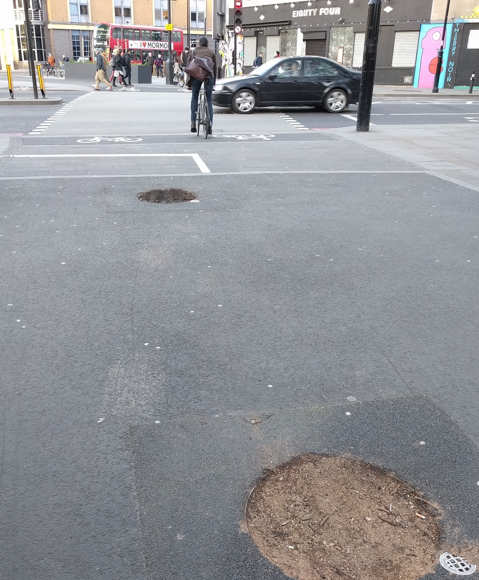
Three trees were in the spot where the cycle track leading to the Old Street crossing was due to go and the plan was to remove these three trees and plant 11 new ones alongside the track instead


However the three trees were, amazingly, left within the new cycle track causing an obstruction and making it difficult to use at peak times


 Two of these trees were finally removed in early 2017


With a new tree planted directly in the centre of the cycle track, leaving just two trees in the track but at least with both of them are now located directly in the middle. 


Boris Johnson's final act as mayor was to order the removal of the shared space signage on the Apex Corner crossing of Old Street, which did occur, and to "install appropriate and effective vehicle blockage of Pitfield Street", which did not


CS1  then moves onto Pitfield Street and Hackney Council state that "Further closures are under investigation to reduce traffic crossing Pitfield Street." Whilst the bottom section of Pitfield Street was closed to motor traffic from Old Street it is still possible to access via Boot Street and this is a route many drivers make. Prior to CS1 Pitfield Street was only open in one direction for motor vehicles but bicycles could use it in both directions. However under the CS1 plans Pitfield Street was opened up to motor traffic in both directions, meaning drivers can now use Pitfield Street to drive south to Old Street, or to City Road via Haberdasher Street, something they could not make before this road became a cycle superhighway 


Pitfield Street before and after CS1

This is especially evident in the morning rush as hundreds of cars and vans use it as a rat run down to Old Street


Hackney Council stated that the zebra crossing next to New North Road would be "raised to slow traffic" and this work was completed in one afternoon shortly after that announcement earlier this year. There is another zebra just 500 feet north of this one, by Crondall Street. A local school, along with the vicar at St. Johns Hoxton church next door, have recently launched a "respect the zebra" campaign, resulting in a commitment from the council of a lollipop person, a slow sign and a repainting of the zebra, three years on from it being repainted as CS1 was constructed. I find it odd that the vicar is dressing up as a zebra to highlight how lorries should be stopping for pedestrians on the zebra crossing yet no one appears to be calling for either the lorries, or the huge numbers of other motor vehicles that clog this road up every morning,  to be removed from this "cycle superhighway" to allow it to be safe enough for children to cycle to school and easier to cross with some traffic reduction


There appears to be no plans for any improvements to Pitfield Street from New North Road up to Britannia Junction, despite this being one of the worst sections of CS1 within Hackney, a very busy road with an awful lot of motor traffic and certainly not the place for anyone "of any age" to be on a bike. The school run, weather on foot or bike, is almost exclusively carried out on the pavement here. 


It is also absurd that such a high number of lorries regularly use this section of Pitfield Street, especially coming from Mintern Street, which is a short 'quietway' route linking Shoreditch Park with CS1, yet is not even filtered!


Cycle super highway 1 and Quietway 16 meet at the Pitfield Street / Hyde Road and Hoxton Street junction. This is the most dangerous junction to cycle on within Hackney and I have written about it previously here. The council are "investigating a scheme to reduce traffic and simplify the junction" less than seven years after spending £600,000 to change it from one of the safest junction designs to the most dangerous! It has been slightly better this year as Penn Street on approach to it is now open in only one direction for motor traffic, reducing the amount of traffic crossing it from East to West but drivers can still use it as a shortcut west all the way from Bethnal Green to New North Road, resulting in near misses and collisions on a regular basis

A tree recently destroyed in a collision at Britannia junction

Again, there appears to be no changes planned for Whitmore Road or De Beauvoir Road from here up to downham Road, which is just unacceptable as motor traffic levels are far too high. I just don't understand why side roads leading off from CS1, such as Orsman Road or De Beauvoir Crescent remain open to motor traffic, let along why Pitfield Street itself is not filtered to stop through traffic from outside the area using it. 
Although not part of the original CS1 consultation a scheme was later proposed in De Beauvoir Town to filter more roads and create a much larger residential area that is free from rat running motor traffic


Most of these closures went into place in 2016, including one which had originally been proposed over 40 years earlier! The exception was De Beauvoir Road which, in response to the consultation, was kept open southbound but closed to traffic northbound. This has still resulted in it being much quieter than it was and also allows crossing De Beauvoir Road on a bike via Q2 much easier. The signage leading up to the closure isn't clear enough it seems, if the amount of reversing lorries is anything to go by. Originally the closure was simply some road signs, which were routinely ignored, but the recently changed layout does seem to be working well.

Getting from the longstanding filtered southern half of De Beauvoir Town to the northern half involves crossing Englefield Road, which can be a challenge at times, especially if you are cycling with young children. The council state that "a parallel pedestrian / cycle crossing is to be installed", which is great news, but I do hope it does not involve any pavement cycling
The new closures are working very well and have dramatically changed the area, creating a much quieter neighbourhood whilst improving the safety of those who choose to walk or cycle through here. I just hope that at the end of the 18 month trial the closures remain and the plastic bollards are replaced with something a bit more permanent. Unfortunately the closures at the junction of Kingsland Road with Stamford Road and Tottenham Road have still not been implemented, despite the consultation closing three years ago and the consultation page stating that they plan to start work in spring 2018.

In the 2015 consultation the majority of respondents opted for option B on Balls Pond Road; a bidirectional cycle track linking Culford Road with Kingsbury Road 


Three years on and work has still not begun on this section of the scheme, with seemingly no date that the works are even likely to start. Hackney Council claim that "this section is jointly maintained by Hackney and Islington and is also on the Strategic Road Network. Discussions are still ongoing but the aspiration remains for a protected cycle lane on Balls Pond Road between its junctions with Culford Road and Kingsbury Road"
It really is unacceptable to take this long to construct this vital part of the scheme. Families who want to use the well promoted "cycle superhighway" are either expected to take their lives into their own hands on such a busy and dangerous road or are forced to break the law and cycle on the pavement 
You can't even rely on an empty bus lane outside of peak hours as it then becomes a car park


North of here there are no plans to improve Boleyn Road, however since the 2015 consultation three new filters have been installed along Wordsworth Road, resulting in another residential area where all streets can be accessed by car but the streets are free from rat running motor traffic from outside the area, leading to quieter and safer roads for residents. 

A new "Cyclists slow down" sign has been installed on the cycle track between Wordsworth Road and Nevill Road alongside the children's posters with similar messages emblazoned onto the railings alongside


I believe a redesign of the cycle track and pavement here to a clearer layout would be a better solution


Before and after from google streetview
The transition as you exit this cycle track onto Nevill Road is quite stark, transferring from quiet streets to a very busy one, clogged with motor traffic at all times 


Hackney Council also recognise this problem and ran a consultation this winter on more proposed traffic filters in this area. Option A would eliminate East / West rat running entirely but would do nothing to solve the issues on Nevill Road and drivers would continue to use it to avoid the Stoke Newington Gyratory. Option B would see a filter on Nevill Road but would still see a West to East route open via Barbauld Road and Dynevor Road. Neither are perfect but option B would clearly be the best outcome for CS1 and those who live on Nevill Road who have to live with all the traffic

At Stoke Newington Church Street the promised traffic islands to provide a safe waiting area for cyclists following CS1 never materialised 


So, as with Balls Pond Road, a fairly important intervention needed as the superhighway meets a busy main road has not occurred and people continue to risk serious injury as they cycle here

Towards the end of CS1 in Hackney it follows West Bank, a one-way road (for cars) with houses along one side and a railway track on the other but with car parking along both sides of the road, leaving virtually no room for contraflow cyclists. 


Another consultation from the council proposes to strip car parking from the railway line side of the road for a bidirectional cycle track. It is a decent proposal as the car parking would not be missed however the local conservative councillor for this area, councillor Steinberger, submitted a 3,300-name petition against CS1 back in 2015, even though all that was proposed was "CS1" to be marked by paint on some residential roads. Some of his objections included increased cycling posing a danger to children and that any increase in cycling would result in increased traffic congestion. I await the consultation report with interest.

Hackney Council should be applauded for recognising that Cycle Superhighway 1 has some serious issues and is largely not a pleasant place to cycle and I'm very glad they seem to be proposing some good solutions to some of the issues. However, it would obviously be welcome if they could actually finish all the adjustments to this route that were promised three years ago but have still not been delivered.